Monday, October 3, 2011

Collies, clouds, and climbing: A misty day on Ben Cruachan

Stob Diamh
The last day of August, 2011 wasn't the fairest day in the month, but we took what we were given and headed out from Glasgow to the north end of mighty Loch Awe. Our goal was a ridge-walk circuit of Coire Cruachan taking in two Munros: Stob Diamh (pronounced Stop Daff, 998m/3274ft, which means Stag Peak) and Ben Cruachan ( 1126m/3694 ft, Mountain of Mounds). We spent about 7 hours on a 16 km ramble along the impressive ridges and tops that make up this group -- and came in for a few surprises before the day was done.

Mountains northeast of Loch Awe
Cruachan group on the left (2007)
Ben Cruachan and Stob Diamh with their
heads in the clouds
Cruachan has been a mountain of interest for me since I first saw it back in 2007. Mike and I, along with friends Jan and Alan, were doing a fall bike ride through the Western Islands and Highlands. In comparison to the August weather of 2011, the fall of 2007 in Scotland was positively tropical, featuring several days IN A ROW of blue sky, sun, and temperatures of at least 18C. On one of those days the four of us were cycling around the west side of Loch Awe and I said "if the sun is still shining after lunch, I'm going in for a skinny dip -- I don't care who sees me!". The weather cooperated and at a grassy beach just south of the small town of Dalavich we all shucked off our clothes and jumped into the loch for a paddle. While cavorting sunny-side-up in the middle of the lake I looked north and caught my first glimpse of Ben Cruachan. It provided a fitting crown to sapphire-blue Loch Awe. That night, over a wee dram, I opined to Mike as how I'd sure like to make it to the top of that mountain.

If the 2011 weather had been better I'm sure we wouldn't have left Cruachan until the end of August -- not after getting such tantalizing views of its airy ridges and granite slabs from our early adventures on the likes of Ben Lui and Ben More. I was always waiting for the "perfect" Cruachan day -- the day when visibility would be so good we'd be able to see all the way from the island of Jura in the south to Ben Nevis and beyond in the north. Sadly, that day didn't come for us on this trip. We seemed to spend those "perfect" days on other mountains, with Cruachan always some place on the western horizon.

Aug 31, when we finally said "now or never", was a cloud-spattered day. I never got the much-hoped-for long vistas, and the shifting mists that boiled up over some of the northern ridges made for a few moments of challenging navigation. But, peek-a-boo glimpses of green and gold slopes and towering red granite walls were more than sufficient to focus our attention and keep us well entertained.

The view from the summit of Drochaid Ghlas
We started our tour right at loch-side and ascended up bracken and heather-covered slopes to the foot of a huge reservoir that covers the bottom of Coire Cruachan. We opted to head east around the reservoir, making for the bealach at Lairig Torran (Pass of Mounds). On our way up the grassy slopes above the water we were treated to the sights and sounds of a shepherd and his working dogs bringing sheep down from the heights. Calls of "come-bye", "away to me", and "that'll do" echoed through the hills, causing the dogs to wheel left and right around their charges. Eventually Mike and I had six Border Collies gambolling around our feet - obviously filled with delight at being out in the mountains, bossing sheep around.

After parting ways with the shepherd and his dogs our next delight was watching a herd of 10 red deer bound across the slopes below us. The scent and sound of the collies disturbed them and they must have thought it best to make tracks across the landscape to some place not so "doggy" . We continued up to Stob Garbh (Stob Garav - Rough Nose Peak), and then on to Stob Diamh. At this point the mist boiled in and we were locked in a silver fog with limited visibility. I was very nervous to continue, especially as I knew the steep, bouldery slopes of Drochaid Ghlas (Droch-itch Glass - Grey Bridge) with its narrow ridge trail around the sheer walls of Coire Caorach (Corra Coe-rach - Corrie of the Rowan Berries) would be next. But, the mist ebbed and we were drawn on, especially entranced by the deep red granite slabs overhanging Caorach.

There were some interesting sections on the route to work our way through. A large slab of granite on the eastern side of the Cruachan final summit ridge proved to be a bit slippery for us, so we had to manoeuvre below the outcrop -- some steep down-climbing, but quite do-able. And then we had to re-ascend the ridge. I hate giving up the high ground so there was a steady stream of rumbling from me for the entire detour! Especially annoying because on a dry day the slab would certainly have been grippy enough to hold us securely on a crossing.

The clouds surged up again as we made our way up the final pitch to the summit of Cruachan. I thought we might have to make do with no vistas at all, but, as we perched on the narrow top, the fog swirled out of sight and gave us keyhole views down into the reservoir and to Loch Awe in the distance. Unfortunately, the outlook north into Loch Etive and beyond was completely obscured -- we only had teasing glimpses of Etive from the summit of Drochaid Ghlas.

Our day on Cruachan ended with a steeply rolling descent to the bealach just below Meall Cuanail (Myowl Coo-anil, Hill of the Flocks). From here it was down directly to the west side of the reservoir. No more collies, deer, or other surprises of nature for us, but we did see two rather ill-prepared hill walkers decide to turn back. And we were happy they did -- Scottish mountains may be small in stature in comparison to our BC giants, but they are due every bit as much respect by those who venture out into them. Certainly, on this wind-pulled misty day Mike and I were more than pleased to be able to pay our respects, and finally put my "naked" ambition of standing on Ben Cruachan's summit to rest.
Weather moving in
Weather moving in


Map of our route:

View Ben Cruachan - Aug 31, 2011 in a larger map

More pictures from Ben Cruachan.

Friday, September 16, 2011

Riding the Glasgow Parks - a tour of some Dear Green Places, Aug 20, 2011

Views from Queen's Park
View over Glasgow from Queen's Park
*Just in case people have the impression that all Mike and I did in the Scottish outdoors was climb the odd hill I thought I'd write a story about one of our more interesting bike rides - a self-guided tour through some of the parks of Glasgow. I think it's fair to say that Glasgow has a love affair with green space. With over 90 parks in the city, Glasgow more than lives up to its "Dear Green Place" moniker. Our 70 km ride wasn't able to take in all of the parks, but those we did make a stop at all had at least one compelling feature. And those features ranged from 330 million year old tree stumps to daring art nouveau architecture to stunning gardens and views -- all for free.

The route plan was largely put together by Mike. His long walks through various Glasgow neighbourhoods gave him good insight into how to get from one park to the next without going through too much traffic. Also, Mike mastered the Clyde Tunnel -- the key to quickly getting from one side of Glasgow to the other. About 1km long, it crosses under the River Clyde quite a bit downstream from the bridges. Cyclists and pedestrians are separated from cars and have their own tunnels, but it can be a devil to find the entrance if you are newcomers to the Glasgow cycling scene.

Our route was circular, starting and ending in our Hillhead neighbourhood. Hillhead is very close to the University of Glasgow, so we travelled west on some of the bike routes through the area to our first stop: Victoria Park and its amazing Fossil Grove. The park was named for Queen Victoria's Golden Jubilee and has some beautiful formal gardens and ponds. But, the thing that drew us to the park was a chance to see the fossilized remains of a forest that grew here 330 million years ago. At that time the terrain Glasgow sits on was located someplace close to the equator and huge forests of giant clubmoss ruled the land. The remains of this forest were found in 1887 when the park was being created. Today you can see the huge fossilized stumps in situ from a viewing platform in the park. Amazing to look at something that old in such detail.

From Victoria we headed for the Clyde Tunnel and nipped by Elder Park in Govan. We were not headed to a park, per se, but to get a view of Glasgow's latest triumph - the Riverside Museum. We were there on June 21st, opening day, and have visited a few times since. It holds the collection of the old Museum of Transportation, but in a new, purpose-built hall. I think the best view of the building itself is from across the Clyde at the Govan public wharf -- and that is where we pulled up.
330 million year old tree stumps
330 million year old tree

Next on the agenda was Bellahouston Park, but we had to cross the M8 motorway to get there. Mike researched the route, and, using the GoBike Glasgow bike map and a bit of navigational expertise got us across on a walkway.

I think Bellahouston is my favourite Glasgow park. It is big (159 acres) and has outstanding views from its highest point. But, the thing I love the most is the walled garden. It is like stepping into a calm oasis of colour and light. The walls cut both wind and sound -- it is a place where you could imagine spending a restful hour reading or sketching.

Glasgow's new Riverside Museum, and the Glenlee sailing ship
Riverside Museum and the Glenlee tall ship
Bellahouston is also famous for the Charles Rennie Macintosh masterpiece - House for an Art Lover. Designed by CRM in 1901, it was not built until the late 1980s. It is a wonderful mix of art nouveau, art deco, and Scottish baronial styles -- curves and lines abound. Somehow it works sitting next to the formalism of the walled garden.

I wish I could have been in Glasgow in 1938 to see the Empire Exhibition which was held in Bellahouston. The pictures from the event paint a scene of modernity and culture fitting into the park setting. 200 pavilions and palaces from all across the British Empire -- in hindsight it must have seemed like a happy summer holiday before the cold winter winds of the Second World War blew across Scotland and the rest of the world.

Mike in front of Pollock House
From Bellahouston we wound our way through a residential area and across the M77 to enter Pollock Country Park. This huge green space holds Pollock House -- a grand old pile of a place alongside the Whitecart Water, the Old Stable Courtyard, and the Burrell Collection. We visited the Burrell Collection earlier - an outstanding assemblage of art, archaeology, and architecture from Sir William Burrell, a rich and eclectic early 20th century collector. The Old Stable Courtyard was having a Highland Cattle show the day we rode through, so we got to see some Highland Coos close up. They are not as menacing as they look.

From Pollock Park it was on to the glass conservatories and city views of Queen's Park. We rode through some elegant Shawlands tenements and had a steep uphill pull to the entrance gates. This park has a reptile house and an aviary as well as a plant conservatory. But, the thing we were most interested in at Queen's Park was the view out over the city. We could see right back to our Glasgow University neighbourhood, and beyond to the Campsie Fells and Dumgoyne hill, above the city.

We then cut down to Linn Park and up to King's Park to visit the sundial. From here we rode north east through Rutherglen to cross the Clyde on the Dalmarnock Road bridge. Next up was Tollcross Park and another glasshouse conservatory. Tollcross has many formal gardens and gazebos, and lots of paths for bikes and pedestrians.

Another port of call on this route was tiny Molendinar Park (at least we think it is called Molendinar) on Craighead Ave in the Royston neighbourhood. This park is only one of two places where you can see the Molendinar Burn. This is the original "Dear Green Place" -- the creek on which Glasgow was founded centuries ago. Indeed, it runs directly to the east of the Cathedral, although today it is covered over for almost its entire length. It can also be seen for a few metres down in the Cathedral precinct, close to the corner of Duke and John Knox St.

Mary in Robroyston Park
Robroyston Park, a mostly undeveloped green space, was next on the tour. Here we gained wonderful views out over the Campsie Fells, once again seeing Dumgoyne hill. Springburn Park, with its ruined Winter Garden conservatory and swooping paths was our most northerly park. We also visited Sighthill Cemetery for stunning views over the city.

From here it was home via George's Square in the downtown and Hengler's Circus pub on Sauchiehall St. We barely made it through the downtown, dodging film crews and road blocks because the new Brad Pitt movie -- something to do with zombies -- was shooting in George's Square. And, of course, any place for a pint is always good for an hour's diversion. We sailed home in the early evening, traversing Kelvingrove, the last park on our route. This park, with broad terraced paths, flower gardens, play areas, and the famous Kelvingrove Museum, was our "home" park. We knew every path by heart, so it was an easy and comfortable ride back to the flat.

All in all, cycling the parks of Glasgow is a very enjoyable way to roll through a summer's day -- not only did the ride have a theme, but we got an up-close view of this diverse and fascinating city.

*As of Sept 7 Mike and I are back home in Victoria, but I still have a few more stories to tell about our time in Scotland, so there will be a few more posts on the blog.

The map of our Glasgow Parks route:


View A bike ride through Glasgow's Parks: Aug 20, 2011 in a larger map


More pictures of our Glasgow Parks ride.

Sunday, August 28, 2011

A Wee Stravaig through the Crianlarich Hills

Mike on Cruach Ardrain - silver tint B&W

In the Scots language of Robbie Burns "oo stravaig" means "we wander", and, as our time in Scotland comes to an end, I can honestly say Mike and I have done our share of wandering. One of our favourite areas to undertake a wee stravaig turned out to be the hills above the West Highland village of Crianlarich. There are seven Munros (mtn. over 914m/3000ft) accessible from town and we've been on all of them. From massive Ben More in the east to craggy Beinn Chabhair in the west, hill walkers in Crianlarich are spoiled for choice.

We've been to the area three times and accessed all start and end points via the bus and Shank's mare. Ben More and Stob Binnein brought us out for a beautiful day in early June (reported on in A Scotland Season - June 3). We next visited on Aug 5th, when we bagged three Munros: Beinn Chabhair (meaning Antler Mountain, pronounced Ben Chavir, 933m/3060ft), Beinn a'Chroin (Mountain of Danger, Ben a Chraw-in, 946m/3103ft) and An Caisteal (The Castle, An Cash-tyal, 995m/3264ft). Our third visit was on Aug 17 when we did Cruach Ardrain (High Mound, 1046m/3431ft) and Beinn Tulaichean (Hill of hills, Ben too-leach-an, 946m/3104ft).

The mist starts to leave Cruach Ardrain
Mist rising off Cruach Ardrain
The difference between the June and August visits was huge -- June 3rd was probably the warmest day of the year. It might have got to 15C in the mountains, but was 24 or 25C in the valley. Our August visits, while full of beautiful light, rising mist, and splashing burns, were more akin to hiking in fall -- a chill was in the air.

Another difference - More and Binnein are frequently travelled. Unless one climbs these mountains in a downpour, other hill walkers will be a common sight. Actually, this is Scotland, and just a downpour wouldn't keep the Scots out of the hills. Indeed, on our worst day of hiking (July 5), when we were forced down from Ben Vane (the smallest of the Munros) by poor weather we encountered an older fellow on the trail. He had already scrambled up and was on his way down. On passing us by he noted "Aye, it's a wee bit damp today, but a fine walk for all that".

But, I digress -- More and Binnein, with their ease of access, and straightforward, if somewhat strenuous approaches, are hiking magnets, while the other five are not so busy. Probably because they are difficult to access and have some tricky navigation and/or scrambling components to work through. Indeed, on our Aug 17 trip we saw no one in eight hours of hiking -- and the day was stunning.

Time to put on the full gear - leaving the Beinn a'Chroin ridge
Mary, about to be entertained on the Beinn a'Chroin ridge
Mike and I are getting quite good at navigation and route finding in the Scottish hills. Both the Aug 5th and 17th trips had us hauling out the British Ordinance Survey map (borrowed from the library in Glasgow -- the libraries in Glasgow are OUTSTANDING -- but that is another story), the compass, and the GPS so we could plan how to get from one ridge to another. We even managed to do this a few times in mist and cloud.

People have asked what I find so entrancing about the Scottish hills, especially when we have such majestic mountains back home. Of course, I love the Selkirks, Monashees, and Rockies, the mountains of my youth in British Columbia's interior. And I look forward with great anticipation to reuniting with my old friends, the Sooke Hills of southern Vancouver Island. But I know I'll miss the amazing washes of light through clouds, the blue-on-blue ranks of tops marching into the horizon, and the understated challenge of getting up and down. Sure, these are not high mountains, but, as with so many enjoyable pursuits, size isn't everything! Indeed, when you read in a Scottish mountain guidebook that a steep cliff "provides an interesting diversion", or a narrow ridge "posses little difficulty" get ready to be entertained. Certainly, a few steps on Ardrain and Beinn a'Chroin fell into the "interesting diversion" category.

All in all, Mike and I have been endlessly entertained on our hill walking expeditions thus far, and hope to get in several more jaunts before winging back to BC. I'll be sorry to leave these mountains, but will look forward to putting Scottish-based rambling skills to work in my home mountains. My goal will be to find an interesting diversion on each and every stravaig; get ready everyone, I'll be bringing a wee bit o'the Bonnie Highlands of Sco'land back in both my feet and my heart.


Maps
Aug 5th - Beinn Chabhair, Beinn a'Chroin, An Casteal

View Beinn Chabhair, Beinn a'Chroin, An Casteal in a larger map

Aug 17 - Cruach Ardrain and Beinn Tulaichean

View Cruach Ardrain and Beinn Tulaichean: Aug 17, 2011 in a larger map


More pictures from Chabhair, a'Chroin, and Casteal
More pictures from Ardrain and Tulaichean.

Monday, August 15, 2011

Munro Two Step – Hill Walking in the Highlands with Lisa and John

Lisa coming up the Stuc a'Chroin summit ridge
Lisa and John on the summit ridge - Stuc a'Chroin
Saturday July 30th was about as pretty a day as Scotland can produce – sunny, but not too hot; breezy enough to keep the midgies down, but not windy enough to blow you off a mountain ridge; and crystal sharp air for excellent visibility. I’m pleased to report that we did not waste it. Lisa, John, Mike, and I got in the rental car and made tracks for the northern slopes of Ben Vorlich, which rise almost directly out of lovely Loch Earn in the Central Highlands.

We did make one necessary stop before the hill though – the Glenturret Distillery, just outside Crieff. We were driving along, John at the helm, when he stops, executes a highway U-turn in the best Scottish tradition and wheels us into Glenturret. John visited this very distillery many years ago on his first trip to Scotland and had fond, if foggy, memories of the place. Lucky for us, because he did acquire a bottle of fine, smooth 10 year old single-malt, some of which accompanied us up into the mountains that very day.

The ridge trail up Ben Vorlich
Lisa on the north east
ridge of Ben Vorlich
Ben Vorlich and its sister peak, Stuc a’Chroin are both Munros and have been on our radar for some time. Mike and I have seen them from many of our other rambles and hoped to make it up to the top of both. They seemed a perfect fit for Lisa and John too, with Vorlich being a sure thing and a’Chroin being do-able if conditions were good.

Sitting boldly over the south side of Loch Earn, Ben Vorlich (985 m / 3231 ft) is one of the most popular Munros for hill walkers to attempt. It has a number of approaches, all quite straightforward. We came up what is arguably the most direct route – due south from Ardvorlich farm along Glen Vorlich, then taking the sprawling north east ridge to the summit. We shared the route and summit with a number of other hill walkers, children, and not a few dogs.

Coming up the steep bit
John coming around
the buttress on a'Chroin
Stuc a’Chroin (975 m / 3,198 ft), however, was another matter entirely. It was about 2:30 pm when we left the summit of Vorlich and made our way down into Bealach an Dubh Chorein (pronounced Bee-lach an Doo Chorrin, meaning “Pass of the Black Corries”) between Vorlich and a’Chroin. Would we have time to do a’Chroin? The route up was steep and scrambly, heading around a buttress of blocky rock. Would everyone give it a try, or would Lisa and I possibly stay back while the fellows made a dash for the summit?

With an agreed upon drop-dead time of 5:30 (time at which we must stop and turn back) we all decided to give it a go. After a few difficult bits coming up the north east gully around the buttress, everyone was on the summit by about 4:30. We gloried in having the broad top entirely to ourselves. Stuc a’Chroin, which means “Peak of Danger” in Gaelic, is technically a lot more challenging than the wide and accommodating tourist track up Ben Vorlich. We were justifiably pleased with ourselves in making both summits, but a’Chroin was especially sweet. Not only was the view outstanding in the soft light of late afternoon, but I was proud of what we had accomplished – good choices, well executed, in an uncertain situation.

Summit of Stuc a'Chroin portrait
Cheers - on Stuc a'Chroin
Our day called for a celebration so John brought out the Glenturret single-malt, complete with shot glasses. We stood on the summit of a’Chroin and toasted our achievement – a Munro Two Step for John and Lisa, and Munros number 14 and 15 for Mike and me thus far.

We returned off Stuc a’Chroin from a small, steep notch in the north west ridge. It was a bit easier than going back down and around the north east buttress – but not by much! At the bottom of slope we began a relaxed contouring around the Dubh Chorein, over the north west ridge of Ben Vorlich, rejoining our original trail on the lower north east Vorlich ridge.

The light of evening was coming on, and I believe we were one of the last groups off the mountain. The trail that was so busy with people coming up was now busy with birds, sheep, and gurgling water. Loch Earn, and an evening dip to wash off the day’s exertions, drew us downwards. By 7:45 pm we were having a splash in the Loch, and by 8:00 were in the car on our way back to Glasgow. I think I am safe in considering this an officially seized day – Carpe Alba!

Hill walkers on the ridge Bealach an Dubh Choirein

A map of our route:

View Ben Vorlich and Stuc a'Chroin in a larger map

More pictures from Ben Vorlich and Stuc a'Chroin.

Friday, August 12, 2011

Gambolling with Goats – our Ben Venue Romp, July 27, 2011


Ben Venue summit views - looking west toward Loch Lomond area
Ben Venue summit - John and Mike on top
 Friends Lisa and John arrived in Bonnie Sco’land on the afternoon of Monday, July 25. The weather was glorious so Mike and I didn’t waste any time in getting them out on a Scottish mountain. We selected beautiful Ben Venue for our first outing and by late Wednesday morning we were making our way up the lower slopes.

Lisa on the summit ridge
Lisa on the ridge to the eastern summit
(the Trig Point)
At 729 m (2391 ft) Ben Venue is not up to Munro height (over 3000 ft), but it is a Graham (Scottish mountain between 2000 and 2499 ft). In fact, it is the 53rd highest out of 224 Grahams in Scotland. But don’t be fooled by its small stature, Venue’s rugged character makes everyone earn their summit ridge views. And fantastic views they are too: lovely Loch Katrine wraps around the northern foot of the mountain; to the east are the aquamarine gems of Lochs Archay and Venachar; south are the green and gold plains of Stirling, the snub nose of Dumgoyne, and – if the day is clear – the towers of Glasgow; in the western distance line after line of craggy peaks dance into the blue curve of the sky.

Mike, Lisa, John - Venue summit
Views from the eastern summit looking
south -- Dumgoyne left over Lisa's shoulder
This is the heart of the Trossachs – Rob Roy and Lady of the Lake country. As fine a walk as you could want to serve as introduction to the Scottish Highlands. Mike and I have been eager to get here for some time. Mike’s Grandfather, Ralph Whitney, climbed Ben Venue after the end of the First World War. It, along with lofty Ben Lomond, gave him an appreciation for the mountains that lasted a lifetime. Our hike gave Mike a chance to see first hand the views that must have greeted Ralph when he did this hike over 90 years ago. I wonder if Ralph glimpsed the steamship Sir Walter Scott plying the waters of Loch Katrine? She has been ferrying visitors up and down the loch since 1900.We saw her glide by as we looked on Katrine from the summit.

Even though the walk got a bit scrambly in places everyone made it up and down with no problem. John fairly trotted to the top, while Lisa was a bit slower, but just as sure-footed. This is a popular walk and we shared the lower part of the hill with several people, but we had the top pretty much to ourselves. Luckily, a group we chatted with lower down, but who came up a different way, approached the summit just as we were about to leave. We asked them about their route up the eastern side of Venue and one fellow hauled out his camera and showed wonderful, close-up pictures of goats. He took them on the way up – so, guess which way we decided to go back down!

Feral goats on Venue's eastern slopes
We romped down Venue’s rolling eastern ridge and soon enough had goats galore – probably about 20 in total. Apparently, feral goats have been known and written about in this territory since the time of Robert the Bruce. This particular population probably stems from a mixture of old stock roaming the hills and dairy goats released in 1918 after the Great War. As we approached several rather severe looking old billy-goats stood guard over their harems and gave us the eye if we got too close. But we all got a good look and took lots of pictures. Mike even tried to stare one down – guess who won!

About this time I began to worry about letting our B&B know that we were going to be delayed – we spent quite a bit of time enjoying the mountain – so I hurried down to the car park where I hoped to get the lend of someone’s cell phone. Sure enough, a Good Samaritan let me use his phone to call our hostess. While waiting for Lisa, John, and Mike to come down I pulled out my copy of Rob Roy – how perfect to enjoy Sir Walter Scott’s book in the very place it describes!

Our day in the Trossachs wasn’t finished when everyone got off the mountain. John saw a body of water close by (Loch Achray) and felt compelled to jump in. Nobody else joined in until a few minutes later when a suitable lay-by (Scottish for “place to somewhat safely pull the car over”) was sighted on the shores of Loch Venachar. Then it was John, Mike, and me for the water – Lisa was the official photographer. I won’t go into detail about who wore what into and out of the water – you’ll have to ask Lisa for the photos!

As evening closed we pulled into Lumsdain House, our farm-stay B&B, alongside the Union Canal close to the town of Linlithgow. Our hostess was waiting with tea and shortbread, and we added to the repast with a champagne picnic dinner out in the back yard – hens at our feet and cows lowing over the fence – a perfect end to a fine Scottish day.

Early evening on Loch Achray


A map of our route:

View Ben Venue in a larger map


More pictures from our romp on Ben Venue.

Wednesday, August 3, 2011

A Wee Sail in the Western Isles: Skye, Canna, and Mull


Loch Scavaig views
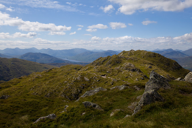
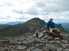
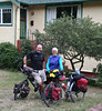
At anchor in Loch Scavaig - the Darwin Sound is 2nd from the right
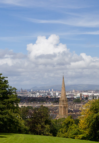
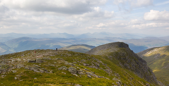
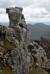
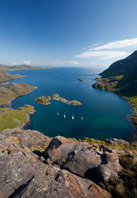
 On the morning of Wed, July 13 the wind was perfect for visiting the Isle of Skye. We lifted anchor, left Eigg behind us and sailed to a spectacular mountain-backed anchorage in Loch Scavaig on Skye’s south west coast. Simon and Karen, along with their dog Pippa, sailed with us on the Lola.

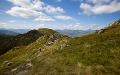
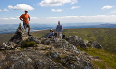
I can tell you that eating well at Scavaig was no problem. Simon dropped a line and caught a brace of mackerel that we grilled up for dinner. Karen made a rhubarb crumble for dessert, and we were well provisioned with wine and spirits. Of course, we deserved it after a bracing sail and a fine afternoon’s exploration on shore. Alan, Mike, and I climbed up one of the shoulders of Sgurr nan Eag in the Black Cullin mountains for a view down on the anchorage. Irene, Simon, Karen, and Pippa explored around Loch Coruisk.

Thursday morning we said goodbye to Karen, Simon, and Pippa – they were headed to Mallaig on the mainland and we were off to the Isle of Canna. Another of the Small Isles of the Inner Hebrides, Canna is owned completely by the National Trust for Scotland. It has one of the best anchorages in the Small Isles (that is not really saying a lot though – as we were to find out), and is home to Sea Eagles, Golden Eagles, Puffins, Kittiwakes, Murres, and Great Skua, to name a few. The hiking, history, and archaeology also make this a fine place to spend time.


Looking down on Canna's harbour
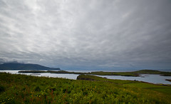
The harbour at Canna
 Our first day on Canna involved a brief trip ashore where we visited the Campbell mansion (Canna was the property of John and Margaret Campbell, and in 1981 they gave the island to the National Trust for Scotland), an ancient Celtic cross from the 8th or 9th century, and an even more ancient standing stone. On our way back to the boat we were invited to a wedding. That night, as dinner was finishing, we heard the skirl of bagpipes across the water. One of the other yachts had a piper on board and he treated the moorage to several selections. We all took a wee dram up to the bow, saluted the day and enjoyed the pipes as the sun sank below the horizon.
Irene takes a break in a field of buttercups, Island of Canna
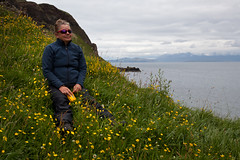
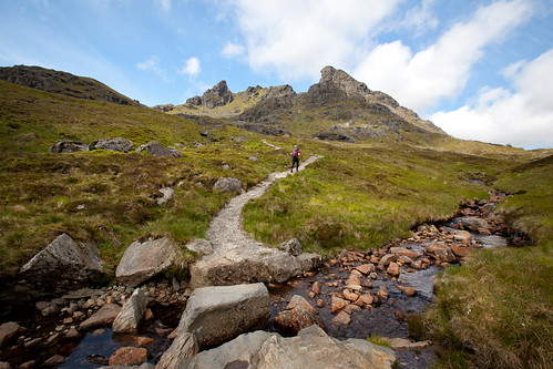
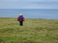
Irene take a break while hiking on Canna

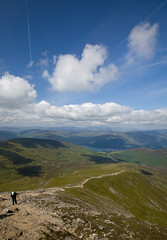
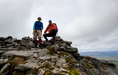
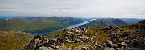
Friday was a bit overcast and windy, but we resolved to stay and give Canna a more complete exploration. We went ashore and visited the remains of an ancient stronghold (small castle), sea cliffs, and high trails. The highlight of the hike was watching a magnificent Sea Eagle swing by us on a thermal updraft. His wingspan looked to be over seven feet. These birds are rare in Scotland with only 33 breeding pairs in the entire country. To see one right in front of my nose was incredible – I went tearing down the cliff top trying to keep it in sight for as long as possible.


Classic "Summer in Scotland" moment
Mary hiking on Canna -- wind in my hair,
chasing Sea Eagles!

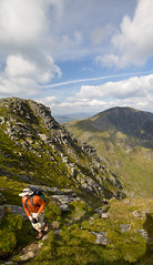
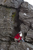
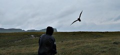
In the late afternoon we met a birder who put us on to a huge colony of Puffins, Murres (called Guillemots here) and Kittiwakes. Alan, Mike and I headed off into increasingly stiff winds to get a look at the birds. Irene decided to return to the boat. She arranged to pick us up with the dingy in a few hours. Our bird watching was a huge success – Puffins and Razorbills galore – to say nothing of Murres, Kittiwakes, and Fulmars. But, the best experience of all was getting attacked by a Great Skua when we inadvertently got too near its nest. The Skua, or Bonxie is a big bird – bigger than a Raven – and it can be very aggressive, making straight at your head with claws outstretched. Mike was leading and was the first “victim”. Needless to say he was quite startled and had to hit the dirt several times before the Bonxie realized there were a couple more of these strange two legged creatures to be seen off.

By now at least an hour and a half has passed since we left Irene. The rain was making itself felt and the wind was blowing very strongly. We made tracks to the agreed upon pickup place, but no Irene. The Darwin Sound was sitting right where we left her that morning, and through the binos we could see the dingy pulled up at the ferry slip – again, right where we left it. We decided that Irene had made friends with someone on her way back to the boat and had stopped to chat. So, we set off around the harbour, a walk of some two kilometres.

Bonxie
Al is attacked by a Great Skua


We met a woman along the way and Alan asked her if there was a “Department of lost wives” on the island, seeing as he had lost his. She said “Och, the Canadian girl. She’s had a wee bit of trouble. Her boat drifted aground”. That set us dashing for the water to check out the Darwin Sound – but there she was, riding at anchor, all safe and sound. I thought the Canna woman was a bit daft.

Turns out she wasn’t daft at all. About 20 minutes after Irene left us she was making her way back to the dingy. In front of Irene’s eyes, the Darwin Sound starts to glide across the harbour heading for the beach. The wind must have pushed the boat strongly enough to have the anchor come up off the bottom, allowing the boat to drift. Another sailor, Steven from the Lady G, also noticed the trouble, put his dingy in the water and headed over to help. He picked up Irene, who by this time was wading out to the boat, and dropped her on board. Irene immediately started the engine, attended to the anchor, and eased the boat back and forth, getting it off the beach and back into position.

The whole process did not take much more than half an hour, but if Irene had not happened by and if Steven had not been on board his boat and ready to help, the Darwin Sound would have been heeled over kissing the Canna sand. The boat did not seem to take any harm, but the same could not be said for Irene. She inadvertently crushed her finger under the companionway door – lots of blood spurting and a very nasty open gash on the finger.

Darwin Sound in Canna Harbour
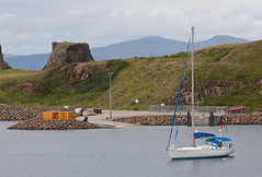
Darwin Sound - safely moored in the
Canna harbour
Of course, by the time we got to the boat all the drama and excitement was over. Irene quite capably handled the entire emergency by herself -- including dressing her own wound, getting hot water bottles ready for the three of us, and preparing a restorative hot chocolate laced with triple sec for everyone to sip.

That evening we made a huge pasta dinner and invited Steven over to thank him for helping out. We had a fine time chatting about some of the darker moments in Scottish history (there are LOTS), sailing, and storms. All this with the wind wailing through the rigging and the boat rolling back and forth – it makes me a bit dizzy just writing about it.

Mary, Al, Irene - Loch Sunart
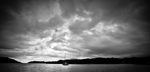
Sailing into Loch Sunart
Alan and Irene kept anchor watch that night while Mike and I crawled into our bunks and eventually drifted off to sleep. Overnight the wind calmed somewhat and the next day, after saying goodbye to Steven and the Lady G, we headed south around Ardnamurchan Point to Tobermory on the Isle of Mull. It was a long sail and the wind was not as kind as previously, so the motor was on until Tobermory. But, after provisioning in town, and setting out across the Sound of Mull into Loch Sunart, we were able to turn off the motor and let the wind and sails do the work. It is such a treat to hear the engines go silent and feel the pull of the wind against sheet and line.

The anchorage at Loch Sunart was spacious and calm. Even though the wind came up you could have played snooker on deck. In the morning Mike and I would head back to Tobermory on Mull and catch a bus and ferry home to Glasgow. That evening, as we sat back enjoying the play of sunset light over the water, we raised a wee dram of Lagavulin whisky and toasted Al and Irene for a wonderful week sailing in the Western Isles.

Map of our sailing adventures:

View Sailing in the Western Isles in a larger map


More pictures from Arisaig and Isle of Eigg.
More pictures from Skye, Loch Scavaig, and Canna.
More pictures from Mull and Loch Sunart.


Loch Sunart in the evening
Sunset on Loch Sunart


Tuesday, August 2, 2011

A Wee Sail in the Western Isles - Arisaig to Isle of Eigg

The Rhu of Arisaig
The opening to Loch nan Ceall, Arisaig
In 1773, Samuel Johnson joined his Scots friend James Boswell in a tour of Scotland’s Western Isles (the Hebrides) that lasted several months – both wrote popular books on the trip. Mike and I got a wee taste of that journey when we joined Irene and Al Whitney on the Darwin Sound, their Dufour Classic 45 yacht, for a week of sailing through the Inner Hebrides. We saw the Small Isles of Eigg, Rum, Canna, and Muck, the southern section of Skye, and the north eastern section of Mull.

Like Boswell and Johnson, Mike and I were both unaccustomed to sailing – the last time we hauled on a rope was in 1991 on the Darwin Sound sailing in the Queen Charlotte Islands off the BC coast. I wish I could say Mike and I were quick studies, and effortlessly picked up the ways of a good sailor, but I don’t think that would be exactly the truth. However, like Boswell, we stood firm to our post, rope in hand, ready to haul when called upon. Actually, let me make a correction: we never hauled on a rope – there are no ropes on a yacht – we stood ready to haul on a line when called.

Mike was much better than me with the lines. I would say my biggest claim to nautical fame was helping get the cover back on the spinnaker sail – kind of like stuffing a giant sausage into a flapping casing. I was also adept at helping get the anchor up. But that was just about the extent of my sailing prowess.

Irene and Al - Rùm in the background
Irene and Al on top of An Sgurr, Eigg
Scotland gifted us with four lovely days out of seven – blue sky, warm temperatures, fair wind, and safe anchorage. The other three days were a bit more tempestuous, with grey skies, a spot or two of rain, less favourable wind, and one anchorage that turned difficult in a matter of minutes.


An Sgurr rising over Eigg
An Sgurr on Eigg

We began our adventure on Monday July 11 with a train trip out from Glasgow to the port village of Arisaig on the west coast. We travelled over the West Highland Line – one of the most scenic train journeys in Britain. The day was sunny and bright and highlights included the windswept crossing of Rannoch Moor, passing by the imposing locks of Neptune’s Staircase in the Great Glen, and chugging around the huge curve of Glenfinnan Viaduct (of Harry Potter fame – although quite famous before the boy wizard came along) 100 ft above Loch Shiel.

We met Irene and Al in Arisaig and spent the evening moored in its calm harbour. After a chance meeting with Simon, a friendly sailor from Eigg, and a bit of time ashore for an early morning hike, we weighed anchor and made for the Isle of Eigg.

Eigg was on my “to-do” list – or, more accurately, An Sgurr, a 58 million year old abutment of pitchstone lava – was on the list. Although not a very high hill (393 m /1,289 ft), its impressive prow of glass-like rock soars above the ocean. After mooring alongside Simon’s wooden boat (the Lola), we took the dingy to shore and headed up. The views from on top of An Sgurr were outstanding – Skye and the Black Cullin mountains blanketing the north, the shaggy volcanic remnants of Rum to the west, the low blue-green Isle of Muck, and the rugged Ardnamurchan peninsula to the south. It was just as beautiful as I had hoped.

IMG_4516The day was very warm and back on board Mike and I took our first dips of the trip – yes, the air temperature was about 18C and the water was 14.5C – summer in Scotland. In we went – I went in several times. We caused something of a stir on other boats moored in the area. That is, until they looked at the stern and saw we were flying the Canadian flag. Somehow, it was almost expected that Canadians wouldn’t feel the cold. Indeed, as I bobbed around with the jelly fish I heard one woman remark “Och, she’s from Canada so she will’na mind the chill”.
Full moon over the ocean - Isle of Eigg

Map of our sailing adventures:

View Sailing in the Western Isles in a larger map


More pictures from Arisaig and Isle of Eigg.

To be continued in the next post .....

Friday, July 22, 2011

The Queen of Scottish Mountains

The long approach to Ben Lui
The Ben Lui approach up Glen Cononish from Tyndrum
It has been a while since I’ve reported on any of our Scottish adventures. I’m sorry about that -- I hope I can make up for it with a story about our Canada Day ramble when we hiked 20 miles and bagged four Munros (Scottish mountains over 914m/3000ft). It was early morning on Friday, July 1 when Mike and I headed up to the Highland village of Tyndrum. The weather forecast was good – some sun, little wind, possible showers. None of that most ominous of Scottish forecasts – “rain, at times heavy” (you ignore that one at your peril!).

We had two mountains firmly in mind; Ben Lui (1130m/3707ft, pronounced Loo-ee, meaning Calf Mountain) and Beinn a' Chleibh (916m/3008ft, pronounced Byn a Chlayv – Hill of the Chest). Ben Lui is regarded by some as the “Queen of Scottish Mountains” because of the perfect horseshoe symmetry of Coire Gaothaich (Corra Goe-ich – Corrie of the Wind) on the mountain’s eastern face. Certainly it drew the eye and focused the attention as we tramped up the long 8km approach from Tyndrum.

Lui, and its lesser consort Beinn a' Chleibh, are usually climbed from the west – a shorter but surely less aesthetic route as the beautiful lines of Coire Gaothaich are hidden from view. Moreover, the eastern approach from Tyndrum up Glen Cononish is not heavily travelled, and on this day we had the mountain vistas all to ourselves. Indeed, we only encountered five other people throughout the entire hike, all of whom we met at the Ben Lui summit.

Looking back to the southern summit of Ben Lui
Summit of Ben Lui - Oss and Dubhchraig in
the background
The Queen of Scottish Mountains is attended by two other Munros; Ben Oss (1029m/3376ft – Hill of Water) and Ben Dubhchraig (978m/3209ft – pronounced Byn Doo-craig - Black Rock Hill), both of which rise over Glen Cononish. Although not commonly taken together, especially as a circle route, Mike and I did talk about the possibility of summiting all four at one go. It would make for a somewhat stiff day, but as we walked up the Glen all four Munros seemed to be calling. The weather was perfect, and, being as we didn’t have anything pressing, except the last bus back to Glasgow at 8:20 that evening, we decided to go for it.

IMG_4319
Mary resting on Ben Oss summit -
Ben Lui in the background
Lui provided an interesting scramble up the south east spur – including a diversion to see the wreck of a 1941 Lockheed Hudson plane – and was the most mentally challenging of the peaks. Oss and Dubhchraig provided exceptional views back into territory we knew (Loch Lomond and Arrochar). But, without a doubt, the return trip down Alt Coire Dubhchraig, followed by a dash along the West Highland Way trail to make our bus, was as physically demanding as any marathon I have ever done.

Even though we were in a tearing hurry, the beauty of Alt Coire Dubhchraig stopped us several times – especially when we came upon a grove of Scots Pines. These trees are remnants of the pine woods of ancient Caledonia that once covered much of the Highlands. They are the Scots equivalent of BC’s old-growth coastal forests. It was a treat to walk through them and imagine what the hills would look like covered with their scaly golden-orange trunks and shiny green tufts of needles.

Scots Pine
Grove of Scots Pine
I wish we could have dallied further, but we had to sprint down the West Highland Way to make the bus. Just picture it – Mike and I, two grey-haired old hikers with packs and boots legging it down a dusty trail, turning the air blue with innovative new curses until all we could do was simply gasp. The last 200 metres we must have sounded like ancient steam engines under load coming up a steep grade.

I’m happy to report that we made the bus – with 12 minutes to spare (it was early!). As we gratefully eased into our seats I said “Mike, I think we’re suffering from Munro fever –32 km of hiking, 1800 metres of vertical, four Munro summits and no time for a celebratory beer or wee dram in the pub – what were we thinking! On our next ramble we’ll travel WITH the scotch”.


Map of the hike

View Ben Lui et. al. in a larger map

More images of Ben Lui et. al. from Mary.
More images of Ben Lui et. al. from Mike.

Wednesday, June 29, 2011

Biking, birding, and a blast from the past

A view of the Sustrans bike path south of Paisley
Sustrans National Cycle Route #7 - close to Lochwinnoch
June 16 was another bright and friendly day in Scotland. Mike and I decided to ride out to visit the RSPB (Royal Society for the Preservation of Birds – we are now members) nature reserve at Lochwinnoch and then push on to Kilbirnie. These are both on the Sustrans National Cycle Network route #7 running south west from Glasgow. We ended up riding 88 km all told – our longest ride yet on this trip.

The day was perfect for riding – not too hot, warm enough for shorts, breezy, but not a wicked wind, and, of course, we were on a traffic-free bike path for most of the way. Paisley and a full Scottish (for those of you not in the know this means breakfast consisting of ALL of the following: eggs, aryshire bacon, sausages, black pudding, potato scone, grilled tomato, and baked beans) was the first order of the day. From here it was on to Lochwinnoch followed by the town of Kilbirnie.

Just after Paisley we diverted off the bike path in the town of Elderslie to see the William Wallace Monument. I’m not talking about the famous one in Stirling – the Elserslie monument is much more human in scale and is part of an archaeological site. As well, Elderslie is considered by many to be the town in which William Wallace (1272 – 1305) was born.

Male Goldfinch
Male Goldfinch - RSPB Reserve
Most people can understand a fascination with a beautiful nature reserve like Lochwinnoch, but fascination with Kilbirnie, a town that was a victim of the Thatcher era and is still an unemployment “blackspot” today, might seem a bit odd. The explanation: Kilbirnie holds a place in memory for Mike and me. It was here that we first stopped for a pint on our 2007 biking tour of Scotland. The day was August 27th and we had only just flown into Paisley that morning. By the time we rolled into Kilbirnie we were thirsty travellers indeed!

IMG_4197
The closed bar in Kilbirnie - so sad, so thristy!
We pulled up to what looked like the only pub in town, parked the bikes on the wall outside the window and wandered in. What a classic working-man’s pub it was – dark, dusty, smelling of whisky, spilled beer, and stale cigarette smoke (no more smoking in pubs in 2007 – thank goodness!). We only just got our beer when a couple of old fellows engaged us in conversation about the death of the town. They had both worked in the big steel foundry that was the mainstay of the place. The spoke of their utter disdain for Margret Thatcher as if she was still a force in their lives. They spoke of spending time on the Isle of Arran, running up Goatfell, Arran’s big mountain, and growing up in a Scottish industrial town. It was a great introduction to Scotland away from the tourist track.

I guess Mike and I are pretty sentimental. Our ride to Kilbirnie was for old time’s sake – and to get another pint at that same pub. Unfortunately, the pub closed last year. But, the friendly reputation of Kilbirnie inhabitants was upheld by a fellow that saw us looking with sadness at the building that used to house the pub. He came over and gave us the full story on the demise of that particular drinking establishment.

We turned for home and had a delightful ride into the soft light of evening. We pulled into Glasgow at about 7:00 and headed to Sauchiehall Street, to Hengler’s Circus pub where we reminisced about past cycling glories and raised a pint to future rides in Scotland.
Two pints, two hands, and two bikes
Here's to more adventures!

Map of Sustran's National Cycle Route #7
More of Mary's Paisley and Lochwinnoch pictures.
More of Mike's Paisley and Lochwinnoch pictures.

Monday, June 27, 2011

The Cobbler + Two

On the trail
Mike on the trail up to The Cobbler
So far the month of June has not been overly generous with warm, sunny days. Whenever one presents itself, we grab it and go. On Tuesday, June 14, Scotland gifted us with just such a day, so off we went to the Arrochar Alps for a multi-peak ramble.

The Arrochar Alps are a group of mountains tucked into the land at the head of Loch Long, and close to the north west side of Loch Lomond. They are made up of a number of peaks (including four Munros – mountains over 3000 feet), but the summit that attracts everyone's eye is surely The Cobbler (aka Ben Arthur). This 884 metre (2900 ft) mountain is supposed to represent a cobbler working shoes at his last – but to me it looks like a Dungeness crab reaching up with its pinchers to catch the sun. It doesn't qualify as a Munro, but for sheer hill walking fun it is hard to beat. However, the day wouldn't be complete without a Munro or two, so after The Cobbler we did Beinn Ime and Beinn Narnain - 1011 m/3316ft and 926m/3038ft respectively.

Mike and I first glimpsed The Cobbler in Sept 2007 from the top of Ben Lomond and I have been lusting after it ever since. When we got down off the bus in the village of Arrochar the morning sun was just hitting the mountain. I couldn't believe my luck in having such a perfect day to fulfill my Cobbler-climbing dreams.

The Arrochar Alps contain some of the most southerly Munros and, with easy access from Glasgow, they can be heavily used. Such was not the case for our day in the hills - we saw only a few people, and all were very friendly. I don't know who makes and maintains the trails in this area, but they are in excellent shape, with large stone steps through areas that could easily become eroded mud-fests.

On the way up we came across two young fellows from the Paisley area (just south of Glasgow) who were out for a ramble in the hills - they were keen to talk about Bonnie Scotland, sports, life in other places, and Scottish politics. Over the day we chatted with several other adventurers, many of whom were much older and moving much faster than us!

Argyll's Eyeglass
The Eyeglass
Approaching The Cobbler from the eastern corrie gave us ample time to gaze up at the interesting summit. Looking at the mountain you might think that the northern crag is the top, but not so. The actual summit is a small pinnacle of rock centred on the ridge between the two "pinchers". To access the true summit you climb through a small hole in the spire. This gap, called Argyle's Eyeglass, leads to a slightly pitched ledge edged with a sheer drop off. You take a few steps along the ledge to a spur of rock jutting out at right angles, scramble up the spur, lever on to the flat top and there you are - on the peak.

Mike on the ledge to the summit scramble
Mike on the summit ledge
Sadly, neither Mike nor I made the actual summit - both of us went out on the ledge and over to the spur. It did not look too difficult to get up, but I knew I would have trouble coming back down. For Mike's part, I'm pretty sure the only thing stopping him from going to the top was me -- because, if he made the summit, he knew I would surely have to try!

Mark and Mike on Ben Ime
On Beinn Ime
After a lunch stop on the northern crag we headed down to the bealach between Beinn Ime and Beinn Narnain. Ime was our next stop, and, after an easy, if somewhat sloggy and boggy ascent, we reached the top of our first Munro for the day. We were greeted by a group of Ramblers (a hill-walking club) who happily filled us in on mountains in the vicinity, and other routes of interest. At 1011 metres, Ime was our highest peak for the day. The views from up top were extensive – we could see Ben Nevis to the north, south to the Isle of Arran, and all through the West and Central Highlands.

We retraced our path back to the high pass bealach and then headed up Narnain. The top of this Munro is a broad plateau of schist, quartz, and mica. We took a rest, mugged at the cairn, and decided to head down off the east ridge. The ridge is a combination of steep fissures and rolling tops. It made for an interesting scramble in the golden light of early evening.

Mike surveys Loch Long and the evening view
Evening views down Loch Long from Beinn Narnain
We regained our trail of the morning and headed down from the hills with chorus after chorus of skylarks singing us on our way. We got back to Arrochar village with just enough time for a quick pint at Ben Arthur’s Bothy. Then it was up onto the bus and away home to Glasgow.


View The Cobbler + Two in a larger map

More pictures from Mary of The Cobbler + Two
More pictures from Mike of The Cobbler + Two

Friday, June 17, 2011

Big Wheels and Great Tits: A biking and birding adventure in Scotland

Scene on the Forth and Clyde Canal
From the banks of the Forth and Clyde Canal
In the last few weeks Mike and I decided to get out on the bikes and travel some of the cycle paths on the Forth and Clyde Canal. This 56 km long waterway connects the River Clyde running through Glasgow with the Firth of Forth on the east coast (just above Edinburgh). There are excellent connections to the canal-side paths from the River Kelvin, which is about 200 metres from our flat.

On our first foray (June 2) we did a little jaunt to Speirs Wharf – an offshoot from the Forth and Clyde going into the heart of northern Glasgow. On June 4th we rode out to under the Erskine Bridge, just above where the canal meets the River Clyde. Our third excursion on June 9th was the longest – 87 km out and back to the Falkirk Wheel.

The Wheel is quite a feat of engineering. It is designed to lift boats from the Forth and Clyde to the Union Canal. The Union, which also has a bike path alongside, goes into the heart of Edinburgh. Boats sail in to a huge bathtub on one end of the Falkirk Wheel and get rotated up 35m/ 115ft into the air from the Forth and Clyde and sail out on the Union. At the same time as a boat is going up, another is coming down. It is really quite something to see the big Wheel in action.


Falkirk Wheel in action
The canals also make for some of the best wildlife habitat in Central Scotland – especially for birds. Some of you might recall that a few years ago back home in Victoria I was able to indulge in a season of NMT (non-motorized transport) birding with friends Jan and Alan. An NMT endeavour involves going out to look at birds via any completely non-motorized means – walking and/or biking are the usual transpo modes adopted. 

The Forth and Clyde Canal certainly has all of the NMT birding prerequisites – accessible biking, interesting birds, and lots of places to stop for a sustaining pint of ale. Mike, however, has admitted to finding bird watching a bit boring. I think he still can’t understand why this activity doesn’t actively involve admiring attractive ladies of the Homo sapiens species.

Great Tit - Closeup
Parus Major
Be that as it may, I believe Mike found his NMT metier on the Forth and Clyde – while stopped along the banks he zeroed in on a group of Great Tits. He was initially attracted by their interesting colouration and jaunty behaviour. Indeed, I was pleased to inform Mike that there are between 300,000 to 450,000 pairs in Scotland. And, due in part to good conservation of suitable habitat, the population has been increasing since the 1960s. So good was the canal-side viewing that I believe Mike is now able to recognize and correctly identify a Parus Major at 50 paces without the aid of binoculars – how many of you can say the same!

Of course, there is a pitfall involved in NMTing at this time of the year on Scotland’s canals – namely Mute Swans. More precisely, Mute Swans with young cygnets. We must have seen 10 families on our ride. One is, by the very nature of the canal tow-path, quite close to both parents and young. Several times (okay, maybe I was trying to sneak up for some cygnet photos) I was hissed and charged and had to beat a hasty retreat. I soon learned to stay well away and use the long lens for any baby pictures.

Hissing swans aside, all of our canal-side rides have rolled us serenely along through bucolic countryside, often with views over the surrounding hills. It seems hard to imagine that these waterways were ever the lifeblood of Scottish industry, teeming with barges, boats, and people on the move. Today life on the canal proceeds at a much slower pace – just perfect for two aging bicyclists. We will certainly return our wheels to the tow-path, all the while keeping our eyes peeled for Parus Major (now you all know the scientific name for Great Tits).

More of Mary's pictures from the canal path.
More of Mike's pictures from the canal path.
Map of the Forth and Clyde Canal and the Union Canal.