Showing posts with label hiking. Show all posts

Thursday, July 18, 2013

A different kind of Eiffel Tower

Pat on the trail to Eiffel Peak
Hike and scramble up Eiffel Peak: Eiffel on the left, Pinnacle Mountain in the middle, Temple Mountain on the left.
Mike and I did our first over 3000 metre peak of the summer: Eiffel Peak in the Lake Louise area, Banff National Park. It was a moderate scramble with a few moves that were made a bit more difficult because of the weather -- nothing like two cold runnels of water running from your hands into your armpits and out your pants to get you moving!

Eiffel Peak is 3084 metres high and affords outstanding views of the Valley of the Ten Peaks (the image that used to be on our - Canadian - $20.00 bill). Temple Mountain, Pinnacle Mountain, and the popular Sentinel Pass are also right in your face on this scramble.
The Valley of the Ten Peaks
Valley of the Ten Peaks
The day started out overcast and cool, and we did get some rain at about 1:00 (just in time for the hard stuff). The trail up was challenging, especially the interminable switch backs up out of Moraine Lake, but once on the mountain the views opened out beautifully. I stopped about once every 100 steps, let my heart rate settle for a moment, and gulped down some water.

Mary on Eiffel Peak - Eiffel Tower in the backgroundWe were a group of six, with Rick, a nurse from Washington state, joining us for the majority of the hike. Doug and Pat - our hosts from Canmore - along with their daughter Arianne and her boyfriend Gijs completed our group. This was a fit group and we moved along smartly. Sadly, I was the caboose on this hike, but I don't think I held the group up too much. And besides, someone has to be last.

This hike and scramble were exactly what I hoped our sojourn in the Canmore area would yield: great views, interesting terrain, some physical challenges, new wildflowers, wildlife sightings, and good times with friends. Here's hoping our Eiffel day will be the start of more to come.

More pictures from the day: Eiffel Peak Scramble.

Map of the route:

View Eiffel Peak via the south east slope in a larger map

Thursday, June 27, 2013

Are those nymphs I see in that pool?


East Charters River - Sooke Hills
The East Charters River, just before joining the West Charters.
Last weekend Mike and I, along with Jan, Judith, and Alan, got out for a 14km hike that took just about the entire day -- and what a well-seized day it was! After a convivial breakfast at our usual haunt (Cup of Joe), we headed west to the Sooke Hills. Our  destination: Charters River off Sooke River Road. We parked outside the hatchery and set off on a lollipop hike (a hike with a small circular route at one end and an out-and-back at the other -- see the map below for a "visual").

We headed up the Grassy Lake trail - a wide and well travelled route - for about 3.7 km. Then followed a small trail off the right of the main track. This took us down to to the West Charters River (some maps call it the North Charters), which was easily crossed at this time of the year. If you check out the OpenStreets map of the Sooke Hills Wilderness , you'll see this trail. It is called the Chimney Trail. From here we joined the Lower Rampart trail, but then carved our own way down the cliffs to the Charters River.

Although Mike had been here before, we were still a bit unsure about how to get down the cliffs, and indeed followed some false leads. But, we got it dialed in and had a fun scramble. The views on the Ramparts made the scrambling well worth it. We got to look back at some of our more familiar routes from a different vantage point. As well, this hike got us into one of southern Vancouver Island's most seldom-visited provincial parks: Sooke Mountain Provincial Park. While on the Ramparts and in the East Charters River bed we were actually in the Park. I've spent a lot of time in the Sooke Hills, but this was the first time I've ever been in Sooke Mountain Park.

On the Ramparts - Sooke Mountain Provincial Park
On the Ramparts
Perhaps the high point of the day was not time spent up on the Ramparts enjoying the view, or the stimulation of route finding, but the time spent down in the bed of the East Charters River (some maps call it the South Charters). This is not something that could be done at any other time of the year: winter and spring have the river flowing wildly, and in fall the chance of a quick cloudburst is too great. But, even with reduced flow I still had to watch my footing as I scrambled up and around huge boulders and clambered over and under logs and trees. All of us took our time on this section.

East Charters River - Maidenhair fern and Red Cedar
In the river bed
The atmosphere in the river bed was green and still, with the river gurgling and springing from pool to pool. We stopped at one of the kettle holes Mike noticed last time he was here. Since we were taking our time, we decided to spend some time taking off our clothes and jumping in. The water was decidedly brisk, but the day was warm and I, for one, was ready for a dip. It was such a "BC moment" to find a secluded spot, shuck off the shorts and splash about. Classic summertime in BC!

I won't offend anyone's eyes with photos of the five of us snorting and blowing like baby Belugas (our ages combine to give 287 years of experience here on Earth -- enough said), but rest assured, photos were indeed taken. Actually, the plants and flowers in bloom along side the Charters were the stars of the show. Delicate Maidenhair ferns turned cliff sides into lacy green grottoes, orange and yellow Sitka columbines nodded brightly at us from rocks and crevices, and many different types of Streambank alums peeked out from under trees and branches. Big Western Red cedar trees drooped huge roots into the water, keeping everything cool and shady. This part of the hike was less than a kilometre long, but it felt like walking back in time. The cliffs and boulders are made of basalt created more than 54 million years ago from underwater volcanoes. They tower above the river bed, but have a softness to their form -- kind of like huge pillows. This effect is caused by the quick cooling of lava being exposed to seawater.
Jan, Judith, Alan, and Mary walking down the Charters River
Jan, Judith, Alan, and Mary

A few cautions about this trip:
  • Firstly, DON'T attempt it if there has been a very recent rain, or if the river is running high;
  • Secondly, DON'T rush the river bed. It can be very easy to turn an ankle here, or worse;
  • Thirdly, if the ages in your party of five add up to more than 280, be VERY careful about who you let see your skinny-dip pictures!  


View The Ramparts and East Charters River in a larger map

More photos from this trip:
Mary and Mike's photos .
Alan's photos .

Sunday, November 28, 2010

Seizing a "Snow Day" in the Sooke Hills

On Saturday, Nov 20th we woke up to snow in the hills and decided to head out and seize the day with a winter frolic. The Usual Suspects (Jan, Alan, Mike, and me) gathered and off we went. There was a bit of discussion about where we should frolic -- Mt. Work, Mt. Wells, Jocelyn Hill, Mt. Manuel Quimper, Braden, Sugarloaf -- any of them should provide a chance for a winter romp. We settled on Mt. Manuel Quimper in the Sooke Hills and started off. We felt sure of a snowy treat, especially as we drove by the Mt. Wells and Braden trailheads. These areas were caked in snow -- the trees were laden and the peaks were rimmed in white. But, as we approached Sooke the snow disappeared -- I didn't want to go to Quimper any more -- I wanted to return to Mt. Wells. Everyone agreed, so back we went. But Mt. Braden called louder than Wells -- and I'm glad we stopped, listened, and climbed because it turned out to be a peak experience in our much-loved Sooke Hills.

Here, even in the deep coastal woods, the snow made its way down to the forest floor. Patterns of salal and sword fern embossed the snow banks and the trees seemed illuminated with new, reflected light. We made our way to Veitch Creek and crossed on a tree and rope bridge, probably laid down by some Sugarloaf climbers tired of getting their feet wet. From here we made virgin steps along the Veitch Creek path to the base of Braden.

Jan and Mike on the lower
slopes of Braden
We elected to go up the well-known southern route that goes by the waterfall, across the flower field, around the fallen Douglas Fir giant, and up onto a series of basalt ledges to the summit. But, snow turns the old and familiar into the new and unusual, and there were lots of stops to examine scenes we would have passed by without a thought in summer. Consequently, it was 1:45 before we got to the top. In these days, when the light goes by 4:30, this winter wonderland gaping would leave us little time for lollygagging.

We spent a happy half hour on the summit, enjoying the sun, staying out of the wind, playing the "what mountain is that" game (it never gets old), and planning future outings. But soon it was time to leave and we had a decision to make -- should we explore a more northerly route down the mountain, or take the south-west route? All of us had travelled the SW route several times, but only Mike had explored the northern path, and that was some years back. Time, knowledge, and calculation of available light made the decision for us -- we took the familiar SW route.

Looking south from the summit
It was the right choice; even on the familiar track we had some backtracking and route-finding. Fortuitous, as it turned out, because we found a new tea stop rock with outstanding views, came across a geological survey marker, and enjoyed the late afternoon light on the hills. We made it to the bottom of the mountain by about 4:10 pm and legged it back to the Veitch Creek crossing. The distance to the crossing was only about 2.3 km, it was getting dark and I wanted to get across the rope bridge in the light. But, our need to hurry didn't cause us to pass by two American Dippers (Cinclus mexicanus -- so why isn't it Mexican Dipper?) plying the upper reaches of the Veitch. None of us had ever seen Dippers on this creek, so it was well worth a look and listen to see these aquatic songbirds dip and swim through the rushing water.

We crossed the tree-rope bridge with no problem and made it back to the car just as a full moon came peeking over the ridge of Mt. Helmcken. On the ride home we all agreed that, no matter your age, playing outside in the snow until it's too dark to see is exactly how you seize a day!

Our route:

View Snow Day on Mt. Braden: Nov 20, 2010 in a larger map

A final picture from Alan's images:
Braden Summit

Monday, September 6, 2010

Two lakes, a summit, and a new route in the Sooke Hills

Any day where I get to multiple lakes in the Sooke Hills is a good one! On Saturday Sept 4, 2010, Mike, Tom and I did an 18 km tour in the north-western part of the Hills.

We started at TLC's parking lot above the Sooke Potholes, hiking along Mary Vine Creek to Peden Lake. We normally stop in at Peden to take a decko at the lake and cabin. I've heard that King Gentian Gentiana sceptrum can be found on the lake margins, and I was hoping to see some this trip. However, as we were getting close to the cabin two hikers came down the trail. They were part of a larger group camping at Peden. We didn't want to disturb them, so passed by without visiting the cabin.

Past the cabin turnoff we took in some views of Peden from a view point above the lake. We saw Stellar's jays and Flickers in the trees and lots of fish jumping -- it was a perfect "lake in the mountains" BC moment.

We then joined the "regular" route to the summit of Empress Mountain, going up the Todd Creek trail. We were soon on the summit approach and just as we got up out of the trees the marine cloud that had blanketed us all morning cleared off -- blue skies and long views waited for us up on top.

Empress Mtn summit
Summit of Empress Mountain
At 682 metres (2238 ft) Empress is the highest point in the Sooke Hills Sea to Sea Green Blue Belt. On a clear day the views from Empress are stunning, and this trip didn't disappoint. From the top looking south you can see a carpet of green and gold running away to meet the blue-on-blue of ocean and sky.

I am so pleased the Land Conservancy and CRD parks were able to put together these wilderness jewels. The vista seems to belong together, with each peak rolling together into the next. Roads and development, no matter how well planned, would segregate and chop this area up into wilderness enclaves, separated from one another by "progress".

I know, I know -- much of this area is second growth, so it isn't as if the Sooke Hills have not known the hand of man. But, much of that logging was well over 50 years ago and the land has come back very well.

From the summit of Empress we went south over the Dumbbell Peaks. These two summits, joined by a high saddle poke up over the landscape like a dumbbell left on the gym floor. Although Mike had been here before, this was a "lifer" for Tom and me. The views, especially of Sheilds Lake, were outstanding.

Hiking the Dumbbells required about 150 metres of steep ascent through young Douglas Fir trees. Then we popped out onto the northern most Dumbbell summit. These rises are perfect examples of "balds" -- open, rocky areas where the vegetation is largely made up of grasses and mosses. The soil is very shallow and can't recover easily from disturbance. In the spring these balds are moist and green, supporting all sorts of wild flowers, Manzanita shrubs, Arbutus trees and Garry Oaks. By fall they have turned golden yellow as the mosses and grasses dry out.

Travel over these balds is delicate. We always try to hike on rocky areas and avoid dislodging the clinging mosses. Certainly this is no area for ATVs or other forms of motorized transport!

From the Dumbbells we crossed some rich salal draws and climbed up Puzzle Peak. Here the geology changed -- it was still basalt, but on Puzzle the basalt had formed into huge columns that seemed to fit together like ... well, pieces of a puzzle (okay -- at least that's what I assumed!).

Grass Lake
Grass Lake in the later afternoon sun
On Puzzle we had views down into Grass Lake, and, after a tea break, headed down to the lakeside. I was very pleased with the condition of the lake and trails around the shore. In past years these trails have been full of deep muddy ruts, caches of garbage, broken bottles, and discarded beer cans. Today the garbage is pretty much gone, vegetation is filling in the ruts, and the lake side is clean. Indeed, we even found a patch of King Gentians in bud on the shore. For me the final confirmation that Grass Lake is clean and healthy came when when we observed a metre-long water snake swimming by, resting on the water lily pads, and then slithering up onto the bank at our feet.If it's good enough for snakes, it's good enough for me!

King Gentian and cedar
King Gentian at Grass Lake
We returned to the Todd Creek drainage via the Harrison Trail. This 5 km route took us by huge basalt cliffs, through deep sword fern communities, and into heavy salal. Tom, who was walking out in front, came upon a bear in the salal, and Mike and I heard one a bit later on. Certainly there was a lot of fresh bear poop in the area.

The final adventure for the day was taking "the pipe" (the old water pipe) back to the car. Tom and Mike opted for that method of return, while I stayed on the Todd Creek trail, crossed the Galloping Goose, and ended up just outside the gates to the lower Sooke Potholes parking lot. I'll only say that I finished the hike 25 minutes before Tom and Mike -- and Mike actually fell off the pipe at one point.

I had my trusty Garmin GPS 60cx with me, so was able to make a reasonable map of the route -- I've included it below.

I very much recommend a ramble in this part of the Sooke Hills Wilderness. Even if you don't head out for the entire trip, a simple out and back to Peden Lake, or up and back to Grass Lake via the Harrison Trail will give you a good feel for the area. And, if you get too hot, you can always jump into one of the lakes and cool off with the snakes!


Sooke Potholes to Peden Lake, Empress Mountain, and Grass Lake

View Empress Mountain via Peden and Grass Lakes in a larger map

Saturday, August 14, 2010

Time, tide, and sunscreen wait for no one


Least Sandpiper
Originally uploaded by Calypso Orchid
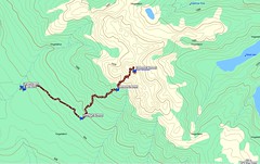
A few days ago I decided to pack up the camera, my big lens, the tripod, and my new monopod and head out to Witty's Lagoon. I was hoping to catch a picture or two of the Dowitcher that Ian Cruickshank reported seeing on the VIBirds list. The moon was just past full, so I knew the tides would be quite extreme, and I was heading for low tide. After consulting the tide tables I set out.

I schlepped everything down the trail to the big barachois that separates the lagoon from the ocean and started to look around for a good spot to sight birds. The lagoon itself, formed by Bilston Creek and tidal action, seemed to hold the most promise.

I am not an expert at bird photography -- in fact, I'm just beginning -- but one thing I do know, good pictures of birds, in fact ANY pictures of birds, take a lot of patience. There is a lot of sitting very still, listening, watching, and waiting. Of course, you have to know your equipment quite well because there may only be one or two moments to get the shot.

Recently I acquired a 500 mm lens that is great for birds. I am too scrawny to hold the darn thing steady enough to shoot without a tripod, so any use of this lens must be accompanied by lugging the tripod too. But, the birds I'm interested in are not often found close to home, so I looked around from something that might be a bit more portable than a tripod. Friends recommended a monopod, and I thought I'd give it a try.

My monopod is made by Manfrotto, the same company that makes my tripods. This meant I was able to interchange my favourite ball head back and forth between the two. I had some luck shooting with the monopod earlier in July when I went up Scafe Hill and got lucky with some Turkey Vultures, so I thought it would work well at Witty's too.

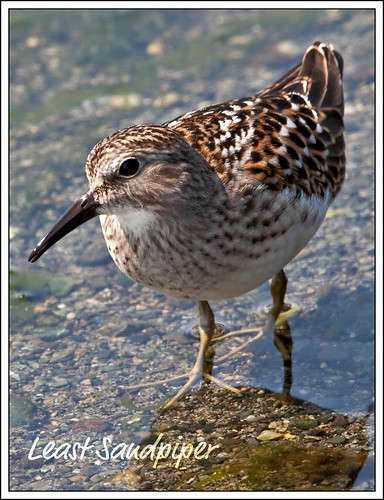
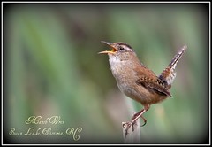
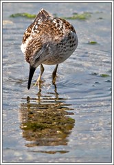
I set up the monopod with the 500mm lens, attached the camera to the lens and ventured out onto the firm banks of the lagoon. There I spied the Dowitcher lounging under a cut bank. It was about 20 - 30 metres away.
Dowitcher at Witty's Lagoon

I very slowly moved forward about a metre, but stopped when I came to the muddy floor of the lagoon. I wasn't about to go out on the mudflats myself -- not only would that be a bit too close to the resting birds, but we are talking REALLY muddy flats -- the dark black, stinking, oozing, full of life type of mudflat birds love.

Even though I wasn't about to venture onto the flats, I thought the even ground would make a better rest for my monopod. So, I stuck the foot of the pod just in front of me, onto the floor of the lagoon. Not a good idea -- the monopod, with about four kilos of camera on top of it started to disappear into the mud.

Within less than a second 10 cm of monopod disappeared into the ooze. In a bit of a panic I stepped forward, the better to get a grip on the shaft and pull the camera and monopod out of danger. Into the mud I went. I started to sink almost as fast as the camera and gear. To make matters worse, it seemed the more I pulled up on the monopod, the deeper and faster I sank.

I saved the day by giving a mighty yank on the monopod, hoisting it up on the bank and then using it to lever myself out of the black suck-hole I had become lodged in. What a sight I was – and talk about stink! I’m happy to report no damage to the camera or lens. I folded up the mono and used the tripod for the rest of the day – it didn’t sink nearly so easily.

In all of this the Dowitcher was giving me a decidedly cool eye -- it seemed to be saying "who is that ungainly three-legged apparition -- what a loser". It slowly and elegantly moved out of camera range and I was left with some underexposed, unusable shots.

Covered to my knees with stinking back mud I ignominiously retreated to the ocean to wash away the evidence of my clumsiness. I was able to wade across the lagoon entrance and check out the other side. The tide was still low enough that I could gain access to a sandbar way out in the lagoon entrance. Off I went, this time in search of Least Sandpiper.

I got lucky -- these entrancing little shorebirds soon became used to the large, still thing out at the end of the sandbar, and wandered out very close to me. I spent a happy hour taking images both through the viewfinder and using the back video screen.

Least Sandpiper
Least Sandpiper Feeding
The feeding and foraging behaviour was fascinating. These birds were pushing their bills through the water, and almost pointing at their food with their feet -- they always seemed to dip their bills to eat right off the end of one foot. I became so engrossed I forgot about the tide. It wasn't until the water has covered the feet of the tripod, causing the camera to tilt at an alarming angle that I looked around me -- the sandbar was pretty much gone. Hoisting the camera overhead, I splashed through the surf back to the beach.

After the lesson with the tide I reckoned I'd done enough shooting for the day and started the hike back to the car park. But, on the way there I decided I wasn't going to let a little mud deter me. I returned to the lagoon to take one more look for that Dowitcher. So glad I did, because I got a few clear shots, although at a quite a distance.

That evening back at home I noticed the last "gift" of the day -- a red swath of skin on the back of the neck. Not only did I forget to pay attention to the tide, I forgot to apply the sunscreen!

Note to self -- remember the time, especially when out beyond the tide line, and apply extra sunscreen just in case. You never know when you'll spend an hour with a Sandpiper.
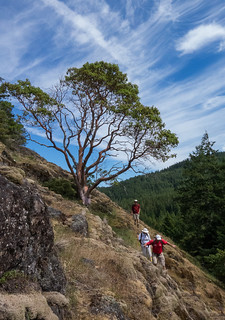
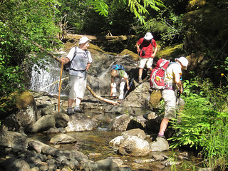
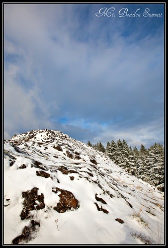
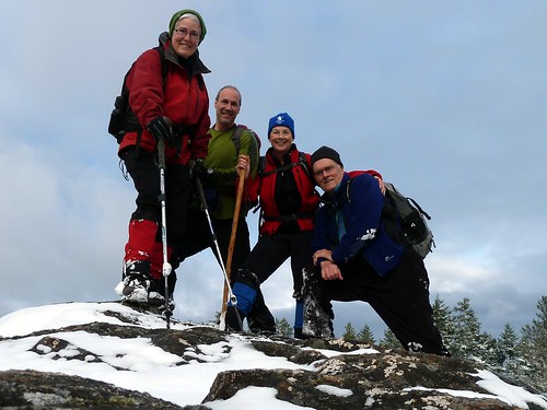
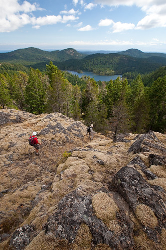
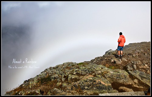
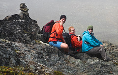
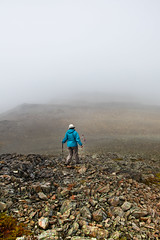
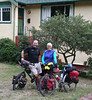
Monday, June 28, 2010

Mt. MacDonald Bumps

June 5 2010: Spring flowers in all their glory, stunning views in all direction, great birds, and fine company -- what more could you ask for in a ramble. Of course, there was some bushwhacking and trail making, but it wouldn't be a hike in the Sooke Hills with Mike and Mary if we didn't explore.

This trip we were accompanied by Ian Cruickshank -- young birder extraordinaire. He is working with the British Columbia Breeding Bird Atlas and had not been in this area before. He got some good breeding info on Ravens and Nighthawks during this adventure and will be back again this summer to check out the area more completely.

Sticky CinquefoilOur trip started with a climb up Mt. MacDonald via the eastern face. We had some interesting flowers here -- a batch of Sticky Cinquefoil Potentilla glandulosa in the Douglas Fir forest on the lower reaches, and wonderful displays of Stonecrop Sedum spathulifolium on the basalt outcroppings. Ian caught sight of an Olive-sided Flycatcher on the nest -- I can tell you , that takes a very good eye. Even with powerful binos and someone to point out the tree, these little nests are difficult to see.

After the summit we did Primus, Secundus, and Tertius Bumps. Between Primus and Secundus we were startled to discover that a huge road had been pushed into the draw between the two Bumps. Ian and I both enquired with CRD Parks and were told this was to be the new access road to the antenna farm at the top of Mt. MacDonald. The current access goes over private property, but this new road is entirely on CRD land. I'm sure this will ease any access issues the CRD might have with the private landowner. I only hope the CRD got a good price for the timber they took out for this road -- it looked to be prime Douglas Fir.

Tufted saxifrage - closeupThe route back down to the valley was interesting -- we went down on the north-west side of Tertius as we usually do, but this time there was no flagging to guide us. The marked trail is now heading down the south-west side. SW is a better path, but we wanted to pass by the quarry lake below Mt. Braden to check for interesting birds, so it was time to do a bit of route finding. With very little cussing we made it down to the Vietch Creek valley. We used one of the old logging roads to wind us back around to the flowline pipe, and from there crossed to Humpback Road through a friend's yard.

This year's spring has been quite cool and wet, but there is an upside -- the flowers stay around much longer than normal. This year the Tufted Saxifrage Saxifraga caespitosa, Sea blush Plectritis congesta, Stonecrop Sedum spathulifolium, and Small-leaved Montia Montia parvifolia were prolific -- especially on the south-western slopes of Secundus. I have never seen such richness on these slopes.

Thursday, May 6, 2010

Trillium - starting to turn colour

The spring show is truly extraordinary this year! The Calypso bulbosa orchids are out in force -- I can't recall when I've seen so many healthy plants. But this year the Trillium ovatum (Western Trillium) are catching my eye. They are also out in profusion. And, during this time of the year -- late spring (at least late for us lucky folks that live on southern Vancouver Island) -- the trilliums start to turn purple with age. Sometimes I can catch them just starting to turn -- like I have this image.

Another favourite at this time of year is the Fritillaria affinis (Chocolate Lily). I am always astounded by the detail and texture on the petals of this plant. I know it is to attract pollinators -- and I think bees pay the most booty-calls to F. affinis! I'm not sure about this -- but in spending time amongst the lilies, I think I have seen more bees in the flowers then anything else.

Bees don't see colour the way we do. They don't see the colours in the red part of the spectrum, but they do see into the ultraviolet. I bet the dark chocolate-coloured patches on the flower absorb UV. I don't have a uv filter, but I'm going to get one to take flower pics --if the chocolate coloured portion of the flower does absorb UV light, then the petals of the lily must look like a huge, high-contrast checkerboard.

The bright yellow flowers of Sedum spathulifolium (Stonecrop) are just starting to show. I love the texture of these plants -- they look plump and lush.
Sedum spathulifolium
Originally uploaded by Calypso Orchid

Lots more colour coming to hillsides up and down Vancouver Island -- the season is just getting into full swing. Take some time to "get out and smell (or at least look at) the flowers".

Tuesday, April 27, 2010

Marsh Wren -- singing for all he's worth

New camera lens -- a 150 - 500 mm. I've been out photographing birds, and this little fellow captured my heart. Here he is, staking out his territory in the bull rushes along the shore of Swan Lake. He flits to the top of the rush and starts belting out his song. At this juncture he is probably warning all other male Marsh Wrens not to come any where close or he'll be forced to do something drastic.

I love the boldly pushed out chest, the ruffled feathers, and the full throated cry. I spent several engrossing hours watching him patrol his territory. He returned to this rush about once every 15 minutes and sang for about 5. Then he would rotate on to another perch and repeat the same process.

I may have found this a lazy afternoon at Swan Lake, but not so for this Wren. He and his compatriots were deeply involved in a tightly choreographed ballet. While this fellow was moving thought his territory at regular intervals, the same thing, on the same interval, was happening with male Marsh Wrens all up and down the verge of Swan Lake.

Amazing what one can observe when one simply sits still and looks.

More images from Swan Lake, Victoria BC

Marsh Wren    


Monday, February 15, 2010

Rambling in the South Island: The Wonder Trail to Thunderbird and Mt. Manuel Quimper

Mt. Quimper crop

For many of us in the Victoria area, the land in the Sooke Hills around Mt. Manuel Quimper, the Thunderbird Cliffs and Ragged Mountain has become a regular feature for weekend rambles. The area has a lot to offer – interesting and unofficial “trails” that require a bit of map reading skill, amazing shows of spring and summer flowers, and some of the best views in the Victoria and Sooke region.

Late afternoon light on Mt. Quimper
This summer Mike and I were busy showing Tom, a Victoria newcomer, the local hiking scene (yes, we've had him out on an ACCVI adventure to Lomas Lake – hopefully he’ll join!). We quickly powered through some of the old favourites and on June 27 we decided it was time to try something with bigger views and some scrambly bits.

Taking advantage of the long daylight we started our walk at a “civilized” hour. We pulled into the car park at Harbour View Road and were on our way by 9:30 am. Our route took us to the top of the Thunderbird Cliffs, back down, and over to Manuel Quimper. Here we went up the north east side and came down the “Mary Trail” -- named after yours truly -- on Quimper's western flank. Then we followed the Harbour Road trail back to the car.

The distance was not long – 14 km in total. We took an enjoyable and leisurely 8 hours to complete the trip. But, the hike does go up and down a bit, and, of course, bushwhacking is a given! Especially in the gully between Thunderbird and Quimper and the last 20 minutes on the western-facing “Mary Trail”. There are other trails that involve less bushwacking, particularly on Quimper. But the western flank is little travelled, especially by mountain bikers, making it prime for flower viewing in spring and summer.

The highlight of this trip is the scramble up the Thunderbird Cliffs, truly one of the premier view hikes in the area. For newcomers especially, this trip lets hikers get the lay of the land around the Victoria/Sooke Basin area.

The Sea to Sea Regional Park Reserve, and the bigger Sea to Sea Blue Green Belt is not particularly “tamed” -- not a lot of maintained trails, published trail maps, or sign posts. Mike and I, along with many of our friends, have spent time wandering around in this area using a combination of topo and compass, very old maps, 20 year old hiking books, and now GPS. We've been inventive in hunting down information too -- once I even phoned a real estate agent and inquired into the purchase of Ragged Mountain, asking for a map so we could "see for ourselves" (hey, I'd buy it if I had a spare million!). We've bushwhacked and barged our way through low spots and blow down, followed promising flagging to nowhere, pussy-footed through delicate Garry Oak habitat, and scrambled up the rocky bits-- always happy to get out and explore, and always looking for "lifers" (new places to hike).

Our first success on putting together Thunderbird with Quimper happened some ten years ago when we first gained the top of Quimper and discovered a map posted in the fire lookout. It pointed us to the Wonder Trail -- a connecting route through the area between Harbour View and Glinz Lake. Stitching together bits of trail, overgrown logging roads, and using the old water main pipe that threads through this area, the Wonder Trail makes a great entry point for Thunderbird especially. If you haven’t been in already, why not tug on the hiking boots and give it a try?

If you know more about the history of the Wonder Trail, or of any other route in the Quimper/Thunderbird/Ragged area, please get in touch -- msanseve@gmail.com -- I'd love to learn more about this wilderness area so close to Victoria.

More photos at Calpyso Orchid on Flickr.

Mary Sanseverino


View Thunderbird and Quimper: June 27, 2009 in a larger map

Monday, September 7, 2009

Why I Love Mountains: Part 2

I am a sucker for a view -- I'll spend hours bushwacking to get to the top of the humps on Southern Vancouver Island so I can get a 360 degree peek at the place where I live. Within moments of getting to the top of whatever chunk of rock is the day's goal, out comes the dog-eared topo map. Then the great (and traditional) "What mountain is that?" discussion starts. Bearings are taken, GPS waypoints are marked, notes are made -- but me and the Usual Suspects (Jan, Alan, and Mike) are slow learners. No matter how many times we head up the old familiar routes to Empress, Thunderbird, Quimper, McDonald, Braden, Sugarloaf, Jocelyn, etc. at the top one of us will be sure to say "Now which one is Mcguire?" or "That must be Warburton Pike" -- and the rush to demonstrate who possesses the most fulsome local knowledge is on.

We have not yet come to blows, but the discussion often ends with a demonstration of navigational prowess -- we all have to align our walking sticks and poles along the ground towards True North. Then Alan hauls out a beautiful sterling silver compass and the winner is decided. Of course, this is considerably more challenging on an overcast day hunkered down under a rock outcrop.

Even though we don't have Jan and Alan for our summer rambles, we still carry on the tradition of going for the big views and discussing the possibility that yes, that could be Mt. Ranier on the horizon, and not just some cloud formation. Doesn't matter who we hike with, or what type of local knowledge they posses, tradition demands we engage in the "What mountain" discussion.

The picture here is from the summit of one of the largest chunks of basalt on Southern Vancouver Island -- Mt. Arrowsmith. It rises 1817 metres (5962 feet) over Port Alberni. The view here is looking south along the ridge of the massif. A huge, steep gully separates the us on the summit from the next hump along. Past that, the mountains extend off into the distance.

I bet on a clear day we could see the Olympic mountains in Washington. There was a great deal of pollution and haze in the air (a heat wave and no wind = ground level ozone and haze), so no crisp views.

Mike and I, along with Tom (relatively new resident of Vancouver Island) and Rod (old friend from St. John's Newfoundland) went up the twists and turns of the Judge's Route. The trail is badly eroded in places and it was often easier to scramble up the adjacent rock faces then stay in the ruts of the trail.

This is a fairly steep hike -- ascending 1 km of altitude in 3 km of trail. No need for ropes, but a helmet might be a safe idea. The views from the summit are worth every grunt and groan. On a clear day you can see right across Vancouver Island from east to west.

I think Mike and I will try to get back this year for a winter hike. Maybe a bit chilly, but the air should be crystal-clear and surely we'll be able to hold a really detailed discussion on "Which mountain is that".

Map of the Judge's Route up Arrowsmith    Mt. Arrowsmith from the Cameron Main   Approaching the saddle


Check out our route on Google Maps:
The Judge's Route .


More pictures from our tramp up Mt. Arrowsmith: Our pics on Flickr .

Friday, August 28, 2009

Why I Love Mountains -- Part 1


I returned last week from a few days rambling in the mountains. I have been working on the pictures I made ever since and I'm reminded why I like mountains -- they always have so much to give -- you just have to be in a receptive frame of mind!
Mike and the "almost rainbow"


Mike and I, along with friends Lisa and John, backpacked in to Strathcona Park, on Vancouver Island. We were only in for a few days, but we did a hike up to the top of Mt. Albert Edward. The weather on summit day was not great -- it rained when we got to the first steep bit. Then wind, mist, and fog dogged us all the way to the top. We spent an hour at the peak waiting for views. And, even though they were not the spectacular vistas I know Strathcona can produce, I found myself deeply satisfied with what we did see.


Mountains in mist and cloud can be so majestic -- especially when the weather gods are teasing you with wispy views. That was certainly the case with Mt. Regan, little brother to Albert Edward. When the day is fine you don't even notice poor squat and lumpy Regan -- but on a day of thready cloud Regan can be the only ghost peak to float into existence.


When you can see them, mountain colours on a grey day can be deep and rich -- all the more so because nothing else competes. On Albert Edward the burnt oranges and dark crusts of basalt seemed to show us a bit of their birthright, formed in heart of volcanoes as they are. Pale pink granite-diorite helped put depth in the view when the mist parted. Flowers were bright spots of colour, covered with jewels of condensed mist. I could surely spend days in this place.

Davidson's Penstemon - closeup      Mike, John, Lisa      Away up the ridge

Tuesday, August 11, 2009

A Two-Dip Summer Day in BC

Summer 2009 has been hot, hot, hot on Vancouver Island. Mike and I, along with Rod, our friend from St. John's NL, decided to try one of the Island's premier backcountry adventures -- the Golden Hinde Traverse. This mountaineering trip takes about 7 days and crosses through the heart of Strathcona Park, in the centre of Vancouver Island. Midway along the traverse sits the Golden Hinde -- at 2200 metres it is the Island's highest peak.

I'm sorry to report that we didn't make the trip -- Rod and Mike were ill with a cold and the last thing I wanted was to be banging around in the backcountry with two old "wheezers"! We only did the first day of the planned hike -- Buttle Lake to Arnica Lake.

In all honesty, I was almost glad we had to cancel. It was so hot I could barely make it to Arnica Lake, and that part of the hike was all in the shade (although an uphill grind). Still, we did enjoy two wonderful dips that day. The first was a skinny dip in Arnica Lake under a bowl of clear blue sky. The second was in the green and cool pool below Myra Falls.

Arnica Lake is a classic sub-alpine pool -- clear water, meadows down to the shore, straight firs reaching for the sky. This one certainly didn't disappoint. After three hours of steady uphill hiking it was a welcome sight. We jumped in almost at once and stayed until I wrinkled.

On our way back to Victoria that evening we decided to make it a two-dip day by hiking down to the bottom of Myra Canyon and taking a dip in the grotto where Myra Falls enters Buttle Lake. The pool here has a definite elvish feel -- like we dropped into a scene from the Lord of the Rings. We had the place to ourselves and plunged in off the limestone cliffs. It was BC-summer-perfect!

There is nothing like spending time floating on your back gazing up at a sunshine-blue sky. Those moments make me sigh, flap my toes, and say "Ain't life grand"!!

More pictures from Arnica Lake


Map of the Arnica Lake Trail, Strathcona Park     Arnica Lake     Sitka Columbine

Check out the full set of pictures at my flickr site: Strathcona Park Hiking, July 26 - 27, 2009