Showing posts with label Sooke Hills Wilderness. Show all posts

Thursday, June 27, 2013

Are those nymphs I see in that pool?


East Charters River - Sooke Hills
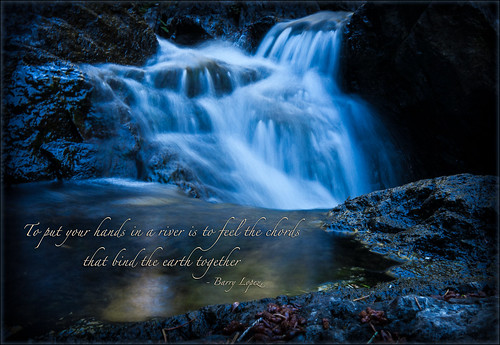
The East Charters River, just before joining the West Charters.
Last weekend Mike and I, along with Jan, Judith, and Alan, got out for a 14km hike that took just about the entire day -- and what a well-seized day it was! After a convivial breakfast at our usual haunt (Cup of Joe), we headed west to the Sooke Hills. Our  destination: Charters River off Sooke River Road. We parked outside the hatchery and set off on a lollipop hike (a hike with a small circular route at one end and an out-and-back at the other -- see the map below for a "visual").

We headed up the Grassy Lake trail - a wide and well travelled route - for about 3.7 km. Then followed a small trail off the right of the main track. This took us down to to the West Charters River (some maps call it the North Charters), which was easily crossed at this time of the year. If you check out the OpenStreets map of the Sooke Hills Wilderness , you'll see this trail. It is called the Chimney Trail. From here we joined the Lower Rampart trail, but then carved our own way down the cliffs to the Charters River.

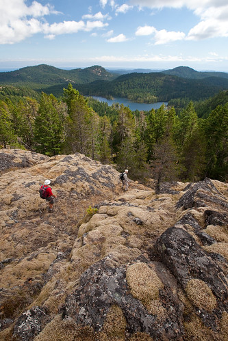
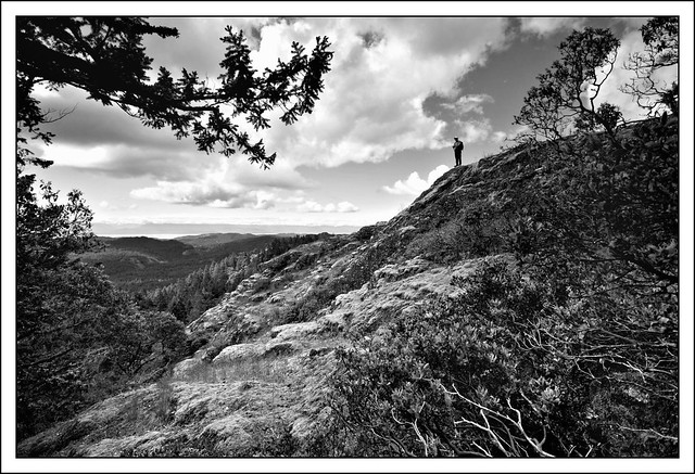
Although Mike had been here before, we were still a bit unsure about how to get down the cliffs, and indeed followed some false leads. But, we got it dialed in and had a fun scramble. The views on the Ramparts made the scrambling well worth it. We got to look back at some of our more familiar routes from a different vantage point. As well, this hike got us into one of southern Vancouver Island's most seldom-visited provincial parks: Sooke Mountain Provincial Park. While on the Ramparts and in the East Charters River bed we were actually in the Park. I've spent a lot of time in the Sooke Hills, but this was the first time I've ever been in Sooke Mountain Park.
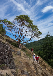
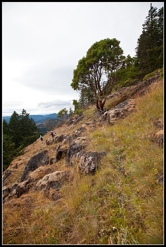
On the Ramparts - Sooke Mountain Provincial Park
On the Ramparts
Perhaps the high point of the day was not time spent up on the Ramparts enjoying the view, or the stimulation of route finding, but the time spent down in the bed of the East Charters River (some maps call it the South Charters). This is not something that could be done at any other time of the year: winter and spring have the river flowing wildly, and in fall the chance of a quick cloudburst is too great. But, even with reduced flow I still had to watch my footing as I scrambled up and around huge boulders and clambered over and under logs and trees. All of us took our time on this section.

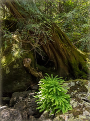
East Charters River - Maidenhair fern and Red Cedar
In the river bed
The atmosphere in the river bed was green and still, with the river gurgling and springing from pool to pool. We stopped at one of the kettle holes Mike noticed last time he was here. Since we were taking our time, we decided to spend some time taking off our clothes and jumping in. The water was decidedly brisk, but the day was warm and I, for one, was ready for a dip. It was such a "BC moment" to find a secluded spot, shuck off the shorts and splash about. Classic summertime in BC!

I won't offend anyone's eyes with photos of the five of us snorting and blowing like baby Belugas (our ages combine to give 287 years of experience here on Earth -- enough said), but rest assured, photos were indeed taken. Actually, the plants and flowers in bloom along side the Charters were the stars of the show. Delicate Maidenhair ferns turned cliff sides into lacy green grottoes, orange and yellow Sitka columbines nodded brightly at us from rocks and crevices, and many different types of Streambank alums peeked out from under trees and branches. Big Western Red cedar trees drooped huge roots into the water, keeping everything cool and shady. This part of the hike was less than a kilometre long, but it felt like walking back in time. The cliffs and boulders are made of basalt created more than 54 million years ago from underwater volcanoes. They tower above the river bed, but have a softness to their form -- kind of like huge pillows. This effect is caused by the quick cooling of lava being exposed to seawater.
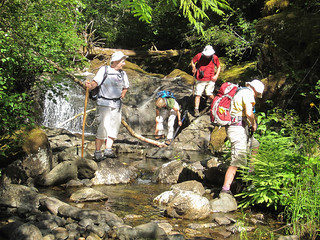
Jan, Judith, Alan, and Mary walking down the Charters River
Jan, Judith, Alan, and Mary

A few cautions about this trip:
  • Firstly, DON'T attempt it if there has been a very recent rain, or if the river is running high;
  • Secondly, DON'T rush the river bed. It can be very easy to turn an ankle here, or worse;
  • Thirdly, if the ages in your party of five add up to more than 280, be VERY careful about who you let see your skinny-dip pictures!  


View The Ramparts and East Charters River in a larger map

More photos from this trip:
Mary and Mike's photos .
Alan's photos .

Monday, September 6, 2010

Two lakes, a summit, and a new route in the Sooke Hills

Any day where I get to multiple lakes in the Sooke Hills is a good one! On Saturday Sept 4, 2010, Mike, Tom and I did an 18 km tour in the north-western part of the Hills.

We started at TLC's parking lot above the Sooke Potholes, hiking along Mary Vine Creek to Peden Lake. We normally stop in at Peden to take a decko at the lake and cabin. I've heard that King Gentian Gentiana sceptrum can be found on the lake margins, and I was hoping to see some this trip. However, as we were getting close to the cabin two hikers came down the trail. They were part of a larger group camping at Peden. We didn't want to disturb them, so passed by without visiting the cabin.

Past the cabin turnoff we took in some views of Peden from a view point above the lake. We saw Stellar's jays and Flickers in the trees and lots of fish jumping -- it was a perfect "lake in the mountains" BC moment.

We then joined the "regular" route to the summit of Empress Mountain, going up the Todd Creek trail. We were soon on the summit approach and just as we got up out of the trees the marine cloud that had blanketed us all morning cleared off -- blue skies and long views waited for us up on top.

Empress Mtn summit
Summit of Empress Mountain
At 682 metres (2238 ft) Empress is the highest point in the Sooke Hills Sea to Sea Green Blue Belt. On a clear day the views from Empress are stunning, and this trip didn't disappoint. From the top looking south you can see a carpet of green and gold running away to meet the blue-on-blue of ocean and sky.

I am so pleased the Land Conservancy and CRD parks were able to put together these wilderness jewels. The vista seems to belong together, with each peak rolling together into the next. Roads and development, no matter how well planned, would segregate and chop this area up into wilderness enclaves, separated from one another by "progress".

I know, I know -- much of this area is second growth, so it isn't as if the Sooke Hills have not known the hand of man. But, much of that logging was well over 50 years ago and the land has come back very well.

From the summit of Empress we went south over the Dumbbell Peaks. These two summits, joined by a high saddle poke up over the landscape like a dumbbell left on the gym floor. Although Mike had been here before, this was a "lifer" for Tom and me. The views, especially of Sheilds Lake, were outstanding.

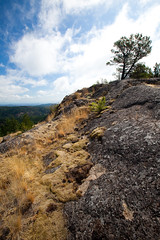
Hiking the Dumbbells required about 150 metres of steep ascent through young Douglas Fir trees. Then we popped out onto the northern most Dumbbell summit. These rises are perfect examples of "balds" -- open, rocky areas where the vegetation is largely made up of grasses and mosses. The soil is very shallow and can't recover easily from disturbance. In the spring these balds are moist and green, supporting all sorts of wild flowers, Manzanita shrubs, Arbutus trees and Garry Oaks. By fall they have turned golden yellow as the mosses and grasses dry out.

Travel over these balds is delicate. We always try to hike on rocky areas and avoid dislodging the clinging mosses. Certainly this is no area for ATVs or other forms of motorized transport!

From the Dumbbells we crossed some rich salal draws and climbed up Puzzle Peak. Here the geology changed -- it was still basalt, but on Puzzle the basalt had formed into huge columns that seemed to fit together like ... well, pieces of a puzzle (okay -- at least that's what I assumed!).

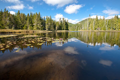
Grass Lake
Grass Lake in the later afternoon sun
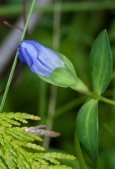
On Puzzle we had views down into Grass Lake, and, after a tea break, headed down to the lakeside. I was very pleased with the condition of the lake and trails around the shore. In past years these trails have been full of deep muddy ruts, caches of garbage, broken bottles, and discarded beer cans. Today the garbage is pretty much gone, vegetation is filling in the ruts, and the lake side is clean. Indeed, we even found a patch of King Gentians in bud on the shore. For me the final confirmation that Grass Lake is clean and healthy came when when we observed a metre-long water snake swimming by, resting on the water lily pads, and then slithering up onto the bank at our feet.If it's good enough for snakes, it's good enough for me!

King Gentian and cedar
King Gentian at Grass Lake
We returned to the Todd Creek drainage via the Harrison Trail. This 5 km route took us by huge basalt cliffs, through deep sword fern communities, and into heavy salal. Tom, who was walking out in front, came upon a bear in the salal, and Mike and I heard one a bit later on. Certainly there was a lot of fresh bear poop in the area.

The final adventure for the day was taking "the pipe" (the old water pipe) back to the car. Tom and Mike opted for that method of return, while I stayed on the Todd Creek trail, crossed the Galloping Goose, and ended up just outside the gates to the lower Sooke Potholes parking lot. I'll only say that I finished the hike 25 minutes before Tom and Mike -- and Mike actually fell off the pipe at one point.

I had my trusty Garmin GPS 60cx with me, so was able to make a reasonable map of the route -- I've included it below.

I very much recommend a ramble in this part of the Sooke Hills Wilderness. Even if you don't head out for the entire trip, a simple out and back to Peden Lake, or up and back to Grass Lake via the Harrison Trail will give you a good feel for the area. And, if you get too hot, you can always jump into one of the lakes and cool off with the snakes!


Sooke Potholes to Peden Lake, Empress Mountain, and Grass Lake

View Empress Mountain via Peden and Grass Lakes in a larger map

Monday, June 28, 2010

Mt. MacDonald Bumps

June 5 2010: Spring flowers in all their glory, stunning views in all direction, great birds, and fine company -- what more could you ask for in a ramble. Of course, there was some bushwhacking and trail making, but it wouldn't be a hike in the Sooke Hills with Mike and Mary if we didn't explore.

This trip we were accompanied by Ian Cruickshank -- young birder extraordinaire. He is working with the British Columbia Breeding Bird Atlas and had not been in this area before. He got some good breeding info on Ravens and Nighthawks during this adventure and will be back again this summer to check out the area more completely.

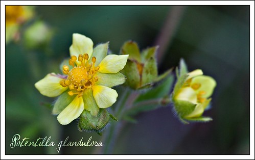
Sticky CinquefoilOur trip started with a climb up Mt. MacDonald via the eastern face. We had some interesting flowers here -- a batch of Sticky Cinquefoil Potentilla glandulosa in the Douglas Fir forest on the lower reaches, and wonderful displays of Stonecrop Sedum spathulifolium on the basalt outcroppings. Ian caught sight of an Olive-sided Flycatcher on the nest -- I can tell you , that takes a very good eye. Even with powerful binos and someone to point out the tree, these little nests are difficult to see.

After the summit we did Primus, Secundus, and Tertius Bumps. Between Primus and Secundus we were startled to discover that a huge road had been pushed into the draw between the two Bumps. Ian and I both enquired with CRD Parks and were told this was to be the new access road to the antenna farm at the top of Mt. MacDonald. The current access goes over private property, but this new road is entirely on CRD land. I'm sure this will ease any access issues the CRD might have with the private landowner. I only hope the CRD got a good price for the timber they took out for this road -- it looked to be prime Douglas Fir.

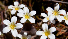
Tufted saxifrage - closeupThe route back down to the valley was interesting -- we went down on the north-west side of Tertius as we usually do, but this time there was no flagging to guide us. The marked trail is now heading down the south-west side. SW is a better path, but we wanted to pass by the quarry lake below Mt. Braden to check for interesting birds, so it was time to do a bit of route finding. With very little cussing we made it down to the Vietch Creek valley. We used one of the old logging roads to wind us back around to the flowline pipe, and from there crossed to Humpback Road through a friend's yard.

This year's spring has been quite cool and wet, but there is an upside -- the flowers stay around much longer than normal. This year the Tufted Saxifrage Saxifraga caespitosa, Sea blush Plectritis congesta, Stonecrop Sedum spathulifolium, and Small-leaved Montia Montia parvifolia were prolific -- especially on the south-western slopes of Secundus. I have never seen such richness on these slopes.

Monday, February 15, 2010

Rambling in the South Island: The Wonder Trail to Thunderbird and Mt. Manuel Quimper

Mt. Quimper crop

For many of us in the Victoria area, the land in the Sooke Hills around Mt. Manuel Quimper, the Thunderbird Cliffs and Ragged Mountain has become a regular feature for weekend rambles. The area has a lot to offer – interesting and unofficial “trails” that require a bit of map reading skill, amazing shows of spring and summer flowers, and some of the best views in the Victoria and Sooke region.

Late afternoon light on Mt. Quimper
This summer Mike and I were busy showing Tom, a Victoria newcomer, the local hiking scene (yes, we've had him out on an ACCVI adventure to Lomas Lake – hopefully he’ll join!). We quickly powered through some of the old favourites and on June 27 we decided it was time to try something with bigger views and some scrambly bits.

Taking advantage of the long daylight we started our walk at a “civilized” hour. We pulled into the car park at Harbour View Road and were on our way by 9:30 am. Our route took us to the top of the Thunderbird Cliffs, back down, and over to Manuel Quimper. Here we went up the north east side and came down the “Mary Trail” -- named after yours truly -- on Quimper's western flank. Then we followed the Harbour Road trail back to the car.

The distance was not long – 14 km in total. We took an enjoyable and leisurely 8 hours to complete the trip. But, the hike does go up and down a bit, and, of course, bushwhacking is a given! Especially in the gully between Thunderbird and Quimper and the last 20 minutes on the western-facing “Mary Trail”. There are other trails that involve less bushwacking, particularly on Quimper. But the western flank is little travelled, especially by mountain bikers, making it prime for flower viewing in spring and summer.

The highlight of this trip is the scramble up the Thunderbird Cliffs, truly one of the premier view hikes in the area. For newcomers especially, this trip lets hikers get the lay of the land around the Victoria/Sooke Basin area.

The Sea to Sea Regional Park Reserve, and the bigger Sea to Sea Blue Green Belt is not particularly “tamed” -- not a lot of maintained trails, published trail maps, or sign posts. Mike and I, along with many of our friends, have spent time wandering around in this area using a combination of topo and compass, very old maps, 20 year old hiking books, and now GPS. We've been inventive in hunting down information too -- once I even phoned a real estate agent and inquired into the purchase of Ragged Mountain, asking for a map so we could "see for ourselves" (hey, I'd buy it if I had a spare million!). We've bushwhacked and barged our way through low spots and blow down, followed promising flagging to nowhere, pussy-footed through delicate Garry Oak habitat, and scrambled up the rocky bits-- always happy to get out and explore, and always looking for "lifers" (new places to hike).

Our first success on putting together Thunderbird with Quimper happened some ten years ago when we first gained the top of Quimper and discovered a map posted in the fire lookout. It pointed us to the Wonder Trail -- a connecting route through the area between Harbour View and Glinz Lake. Stitching together bits of trail, overgrown logging roads, and using the old water main pipe that threads through this area, the Wonder Trail makes a great entry point for Thunderbird especially. If you haven’t been in already, why not tug on the hiking boots and give it a try?

If you know more about the history of the Wonder Trail, or of any other route in the Quimper/Thunderbird/Ragged area, please get in touch -- msanseve@gmail.com -- I'd love to learn more about this wilderness area so close to Victoria.

More photos at Calpyso Orchid on Flickr.

Mary Sanseverino


View Thunderbird and Quimper: June 27, 2009 in a larger map