 |
| The East Charters River, just before joining the West Charters. |
We headed up the Grassy Lake trail - a wide and well travelled route - for about 3.7 km. Then followed a small trail off the right of the main track. This took us down to to the West Charters River (some maps call it the North Charters), which was easily crossed at this time of the year. If you check out the OpenStreets map of the Sooke Hills Wilderness , you'll see this trail. It is called the Chimney Trail. From here we joined the Lower Rampart trail, but then carved our own way down the cliffs to the Charters River.
Although Mike had been here before, we were still a bit unsure about how to get down the cliffs, and indeed followed some false leads. But, we got it dialed in and had a fun scramble. The views on the Ramparts made the scrambling well worth it. We got to look back at some of our more familiar routes from a different vantage point. As well, this hike got us into one of southern Vancouver Island's most seldom-visited provincial parks: Sooke Mountain Provincial Park. While on the Ramparts and in the East Charters River bed we were actually in the Park. I've spent a lot of time in the Sooke Hills, but this was the first time I've ever been in Sooke Mountain Park.
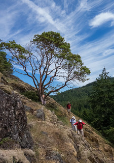 |
| On the Ramparts |
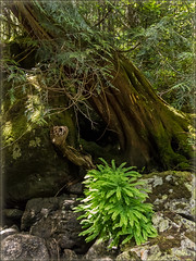 |
| In the river bed |
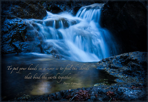
I won't offend anyone's eyes with photos of the five of us snorting and blowing like baby Belugas (our ages combine to give 287 years of experience here on Earth -- enough said), but rest assured, photos were indeed taken. Actually, the plants and flowers in bloom along side the Charters were the stars of the show. Delicate Maidenhair ferns turned cliff sides into lacy green grottoes, orange and yellow Sitka columbines nodded brightly at us from rocks and crevices, and many different types of Streambank alums peeked out from under trees and branches. Big Western Red cedar trees drooped huge roots into the water, keeping everything cool and shady. This part of the hike was less than a kilometre long, but it felt like walking back in time. The cliffs and boulders are made of basalt created more than 54 million years ago from underwater volcanoes. They tower above the river bed, but have a softness to their form -- kind of like huge pillows. This effect is caused by the quick cooling of lava being exposed to seawater.
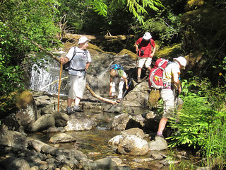 |
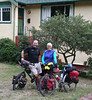
| Jan, Judith, Alan, and Mary |
A few cautions about this trip:
- Firstly, DON'T attempt it if there has been a very recent rain, or if the river is running high;
- Secondly, DON'T rush the river bed. It can be very easy to turn an ankle here, or worse;
- Thirdly, if the ages in your party of five add up to more than 280, be VERY careful about who you let see your skinny-dip pictures!
View The Ramparts and East Charters River in a larger map
More photos from this trip:
Mary and Mike's photos .
Alan's photos .


0 comments:
Post a Comment